The Weather Blog
Daily weather updates
Will We See Six More Weeks Of Winter? – 1-2″ Of Snow Saturday
Super Bowl Weather

The Minnesota Climatology Office has put together a page showing climatology facts for February 4th in the Twin Cities – the date of Super Bowl LII. Here’s what they say about snow depth and amount of sunshine in early February:
“In reality, the weather for the first week of February can vary greatly. At times, it can be the coldest part of the winter and “sporting” some of the deepest snow depths. The chances of seeing no snow cover occurs in about 1 in 10 years. Having a snow depth of about six inches happens about half the time and having at least a foot of snow on the ground is about 15% of the time. It is also the time of year that the length of day light becomes noticeably longer. By February 4, there is about one hour and fifteen minutes of extra daylight since December 21. On February 4, 2018 the sun will rise at 7:29 am and set at 5:25pm, Central Standard Time in the Twin Cities.”
The Southeast Regional Climate Center also has a fact sheet on past weather for all Super Bowls. According to their data, the coldest high for a dome game was 16 back in 1982 (played at the Silverdome in Pontiac, MI). The coldest high for a non-dome game was 43 back in 1972 (played at Tulane Stadium in New Orleans, LA).

It looks like we will see the coldest Super Bowl on record Sunday here in the Twin Cities, as highs only climb into the single digits. Wind chills will remain below zero all day.
_______________________________________________
January Recap

The Twin Cities ended the month above average in the temperature, precipitation and snowfall departments. We ended the month one degree above average, with an average temperature of 16.6°. The 20.4″ of snow we saw means that January 2018 will go down tied for the 11th snowiest January on record in the Twin Cities.
_______________________________________________
_______________________________________________
Phil Prognosticates Today – 1-2″ Of Snow Saturday
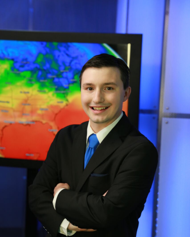
By DJ Kayser, filling in for Douglas
Today is the day each year when we supposedly hand over the long-term forecast over to a lone groundhog named Punxsutawney Phil. Early this morning he’ll crawl (okay, more like be taken) out of his hole in Pennsylvania to tell us whether there’s six more weeks of winter or if spring will arrive early. Since Phil started predicting in 1887, he has seen his shadow a whopping 103 times – meaning he’s predicted a continuation of winter 79% of the time.
I don’t have to see my shadow to accurately predict that winter will continue across the state over the next week. Highs will be in the single digits and teens with sporadic snow chances. The best snow opportunity at the moment looks to arrive Saturday, bringing a fluffy 1-2” across southern Minnesota.
Sunday could easily be the coldest Super Bowl on record – dome or no-dome – with highs in the upper single digits. Any chance we can move “LII” outdoors, so that Philadelphia and New England fans can get a real taste of winter in Minnesota?
_______________________________________________
Extended Twin Cities Forecast
FRIDAY: Scattered PM snowflakes. High 13. Low 8. Chance of precipitation 20%. Wind SW 3-8 mph.
SATURDAY: 1-2″ of fluffy snow. High 14. Low -3. Chance of precipitation 70%. Wind N 5-10 mph.
SUNDAY: AM clouds, PM sun for “LII”. High 8. Low -3. Chance of precipitation 10%. Wind NW 5-10 mph.
MONDAY: Late day snow, especially south. High 14. Low 1. Chance of precipitation 30%. Wind SW 5-10 mph.
TUESDAY: Sun and clouds. Overnight snow chance. High 13. Low 0. Chance of precipitation 10%. Wind NW 3-8 mph.
WEDNESDAY: Skies slowly clear. High 15. Low -3. Chance of precipitation 10%. Wind NW 5-10 mph.
THURSDAY: Cloudy. Late day snow chance. High 16. Low 3. Chance of precipitation 20%. Wind SW 5-10 mph.
_______________________________________________
This Day in Weather History
February 2nd
1996: The all-time state record low temperature is set in Minnesota. With numerous media folk present, the low dips to -60 three miles south of Tower. Governor Arne Carlson cancelled school statewide due to the cold.
1988: The temperature bottoms out at -43 at Embarrass.
1927: Spring-like temperatures are felt on Groundhog Day. Tracy is 57 and Fairmont reaches 56.
_______________________________________________
Average Temperatures & Precipitation for Minneapolis
February 2nd
Average High: 25F (Record: 48F set in 1991)
Average Low: 9F (Record: -32F set in 1996)
Average Precipitation: 0.03″ (Record: 0.80″ set in 19832)
Average Snow: 0.3″ (Record: 8.8″ set in 2016)
_______________________________________________
Sunrise/Sunset Times for Minneapolis
February 2nd
Sunrise: 7:31 AM
Sunset: 5:22 PM
*Length Of Day: 9 hours, 51 minutes and 7 seconds
*Daylight Gained Since Yesterday: ~2 minutes and 37 seconds
*Next Sunrise at/before 7:30 AM: February 3rd (7:30 AM)
*Next Sunset at/after 5:30 PM: February 8th (5:31 PM)
_______________________________________________
Minnesota Weather Outlook

Temperatures will be warmer across the state Friday versus Thursday, warming into the teens across central and southern Minnesota (with some 20s across southwestern parts of the state). Highs will remain in the single digits across northern Minnesota. We will be watching the chance of some light snow showers, mainly during the afternoon to overnight hours.

Even though highs will be warmer on Friday, they will still be 5 to 15 degrees below average for this time of year across most of the state.
Warmer weather (teens above zero for highs) will continue through Saturday before another blast of cooler air works in in time for Super Bowl Sunday. We’ll moderate back into the teens for highs then as we head into next week.

While a few light snow showers will be possible across the state Friday, a better chance of snow works in Saturday across southern Minnesota, where a band of 1-2″ of fluffy snow will be possible.
We’ll then continue to watch a few sporadic chances of light snow in the forecast as we head through next week here in the Twin Cities as clipper systems pass through or near the region.
_______________________________________________
National Weather Forecast

A few showers will be possible across the Mid-Atlantic and Southeast, with snow showers across the Northeast, Friday (especially in the morning hours) as the cold front that has been pushing east continues to move further offshore. Lake effect snow will be in progress across parts of the Great Lakes throughout the day before another burst of snow moves across the upper Midwest and Great Lakes by the evening and overnight hours. Rain and higher elevation snow will continue across the Northwest.

Cooler than average weather is expected Friday across most of the eastern U.S. behind a cold front that moved through the region. In some areas, highs will be up to 20 degrees below average. Warmer weather will continue out west, where parts of the Southwest will be up to 15 degrees above average.

The heaviest precipitation over the next five days (through Tuesday morning) will be across the Northwest, where 2-4″+ of liquid precipitation is possible. Across the southern and eastern U.S., another frontal system will move through during the weekend and into early next week, bringing more rain (and northern snow) to the region.

Feet of snow will be possible at the higher elevations in the Northwest through Saturday evening as numerous systems continue to move through the region. Snow of a foot or more will also be possible due to lake effect snow in prone areas downwind of the Great Lakes.
_______________________________________________
Gulf Of Alaska Earthquake – January 23rd

The USGS has released more information on the January 23rd earthquake in the Gulf of Alaska: “One week ago, on January 23rd at 12:31 a.m. local time, Alaskans were rocked by a magnitude 7.9 earthquake, with an epicenter in the Gulf of Alaska, about 350 miles southwest of Anchorage, and about 175 miles southeast of Kodiak Island. Four minutes later, Alaskans in coastal communities were awakened with blaring alarms when NOAA’s National Tsunami Warning Center sent out a Tsunami Warning for the state and the west coast of Canada based on the quake’s magnitude and its proximity to the coast. At the same time, a Tsunami Watch was issued for California, Oregon, and Washington. Ultimately, a small tsunami surge, less than one foot deep, was observed in Kodiak and smaller water-level increases occurred in other Alaskan coastal communities. A water-level rise of a few inches was detected four and a half hours later in Arena Cove, California. Three hours after the initial tsunami advisory was issued, NOAA canceled it.”
Winter And Insects

How do insects survive in winter? The Midwest Regional Climate Center takes a look: “Midwestern winters are too cold and long for most insects to survive without special adaptations or strategies. In cold northern latitudes, insects will either 1) migrate south to spend the winter months in warmer climates (e.g. monarch butterfly) or 2) overwinter locally. Overwintering insects enter a state of inactivity known as diapause; think hibernation for insects. In this state, an insect’s metabolic rate drops, growth stops, and stored body fat is used to survive the winter. Insects can diapause as adults, larvae, pupae, or eggs depending on the species. Some insects are ‘freeze tolerant’ and can keep their bodies from freezing by producing alcohols that act as antifreeze. However, most insects in the Midwest choose to avoid freezing and may even seek shelter inside our homes.” (Image: Asian multicolored lady beetles invade home during the winter. (Photo by Joe Boggs, Ohio State University))
Colombian Youth File Climate Lawsuit

The first Latin America climate lawsuit has been filed – by young Colombians. More from Earther: “Young Colombians are taking the government to court over the environment. The 25 plaintiffs, whose ages range from 7 to 26, filed a lawsuit in Bogota Monday demanding a right to a healthy environment free of deforestation and the irreversible impacts from climate change. The suit calls explicitly for the federal government to create an action plan to reduce the Amazon’s rapid deforestation by 2020. (That’s also what President Juan Manuel Santos promised during the 2015 Paris Climate Summit.)” (Photo: AP)
New York Expanding Offshore Wind Energy

The governor of New York believes that wind energy will be a $6 billion industry by 2028, and wants to build new turbines offshore in the upcoming years. More from WSHU: “With the release of its master plan for offshore wind energy, New York State is doubling down on its commitment to renewable energy at a time when the Trump administration is moving to allow coastal drilling for oil and gas. The plan calls for hundreds of turbines to be built on a one million acre site in the Atlantic Ocean at least 21 miles south of the Great South Bay, ensuring that none of the turbines would be visible from the shoreline. Estimates say that the windfarms would generate 2,400 megawatts of power by the year 2030 – enough to power more than a million homes.” (Image: MATT YOUNG / AP)
_______________________________________________
Thanks for checking in and have a great Friday! Don’t forget to follow me on Twitter (@dkayserwx) and like me on Facebook (Meteorologist D.J. Kayser)!
– D.J. Kayser


