84 F. high temperature on Sunday in the Twin Cities.
84 F. average high on July 19.
79 F. high on July 19, 2014.
July 19, 2000: A National Weather Service cooperative observer south of Tower reported a morning low of 29 degrees. Embarrass reported 31 degrees.
July 19, 1987: The town of Floodwood lives up to its name with nearly 6 inches of rain in two days.
“Going Pioneer”
Electricity is for sissies. Somehow, the pioneers who settled Minnesota in the 1800s were able to get by without blow driers, microwaves or Netflix. So can I.
Awake at sunrise, asleep at sunset. Deodorant? That’s what the lake is for! Blow the cobwebs off a “book” – take in a free sunset. Remember the words of a favorite meteorology professor: “Nature owes us no favors. We’re simply along for the ride.”
It’s good for your waistline too. I’m on the “Pioneer Diet”. The food in my ‘fridge has spoiled = fewer temptations for snacking.
I’m trying to put a positive spin on a lack of power, but it’s a little like sugar-coating a buffalo chip. This too shall pass. My take-away: take nothing for granted, including electricity. And a quiet, benevolent sky.
A few showers and T-showers brush far southern Minnesota today, but most of us will enjoy a dry sky into Thursday. Temperatures trend a few degrees above average – near 90F by the weekend.
No severe storms brewing, which is reassuring. I’m starting to get paranoid: 2 tree-ripping, power-slashing derechos in 5 days. I fear Mother Nature is stalking me. “Remind me not to be anywhere near you!” texted meteorologist Todd Nelson.
Was it something I said?
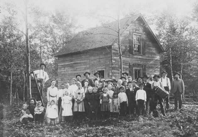
* Photo credit above: Hovland, Minnesota neighbors. Photo: Chicago Historical Society and prx.org.
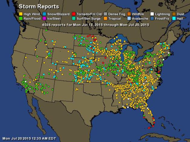
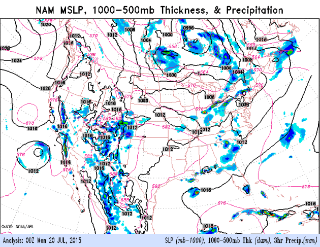
Over 4,000 Reports of Severe Weather in the Last Week. Data from NOAA SPC and AerisWeather – the storm report map looks more like mid-June than mid-July.
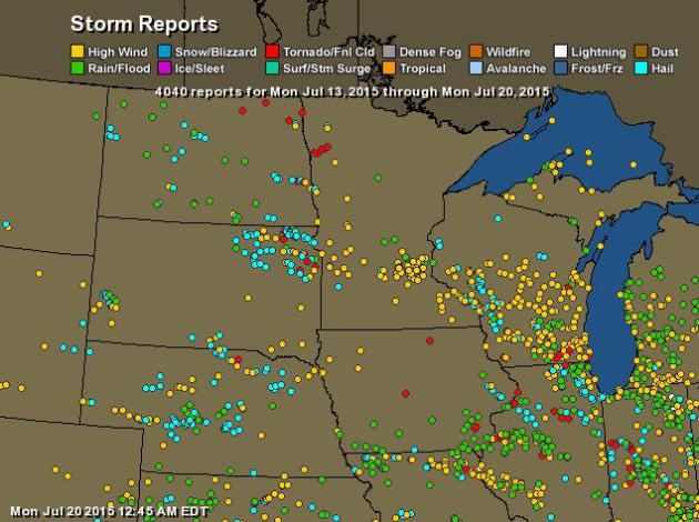
Windblown. The yellow dots signify severe winds (in excess of 58 mph, in some cases much higher than that). Red dots are tornado touchdowns and blue dots show the location of severe (1″+) hail reports.
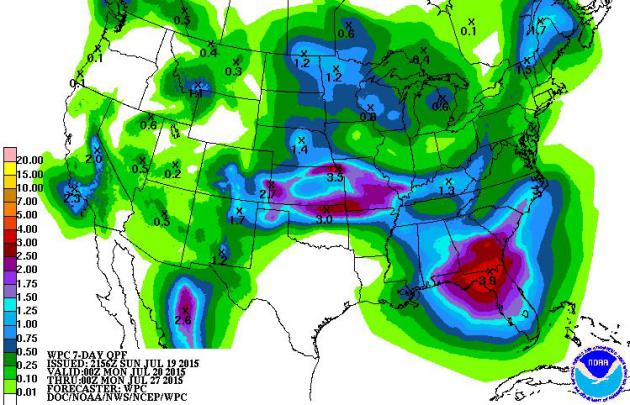
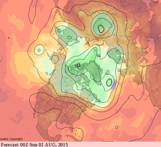
7-Day Rainfall Potential. NOAA is forecasting as much as 4″ of rain for the Florida Panhandle by Monday of next week; another stripe of excessive amounts possible from the central Plains into the middle Mississippi Valley. Most of Minnesota is predicted to pick up .50″ to 1″ of rain in the next week; the best chance of 1+” over the Red River Valley.
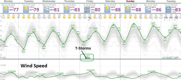
Driest Weather Comes First Half of This Week. Late week doesn’t look terribly wet, but most of the models bring a line of showers and T-storms across the state of Minnesota on Friday. An isolated instability T-shower can’t be ruled out over the weekend, but with afternoon highs near 90F both days the atmosphere may be capped, a layer of hot, dry air near the surface “capping” the potential for convection.
Relatively Quiet. With any luck we won’t be tracking fledgling derechos or severe downbursts again anytime soon. The risk of anything severe will be low, even on Friday, when the dynamics aloft, temperature, moisture and winds probably won’t favor supercells. I still think the European guidance above is a few degrees too cool. By the weekend there will be no doubt that we are still in the prime of summer heat.
The Cusp of Uncomfortable. Everything I’m seeing suggests to me that the core of the heat, the really nasty stuff (heat and humidity combined) will remain just south and east of Minnesota into early August. We may see a few more days topping 90s, but not the sustained 90s impacting much of the USA right now. Just hot enough.
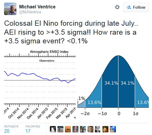
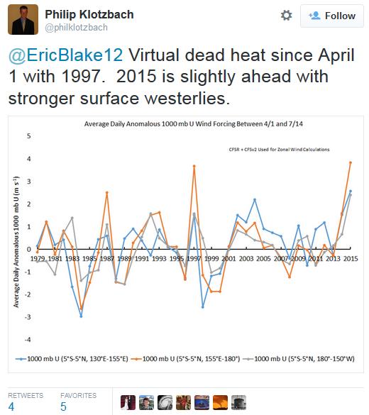
Biggest El Nino Since 1997-98. At the rate we’re going I wouldn’t be surprised. So far NOAA and other organizations have consistently underestimated the strength of the warming waters in the Pacific. The tweets above show some of the reaction to what oceanographers are tracking. It’s going to be a very interesting fall and winter at the rate we’re going.

TODAY: Partly sunny, showers far south. Winds: NW 15. High: 83
MONDAY NIGHT: Clear and pleasant. Low: 60
TUESDAY: Sunny and beautiful with lower humidity. High: 82
WEDNESDAY: Some sun, isolated T-shower. Wake-up: 65. High: 83
THURSDAY: Warm sunshine, no weather drama. Wake-up: 69. High: 87
FRIDAY: Few T-storms possible. Wake-up: 70. High: 88
SATURDAY: Sticky sun, good day for the lake. Wake-up: 73. High: 91
SUNDAY: Touch of dog days: hazy, lazy sun. Wake-up: 72. High: 90
Climate Stories….
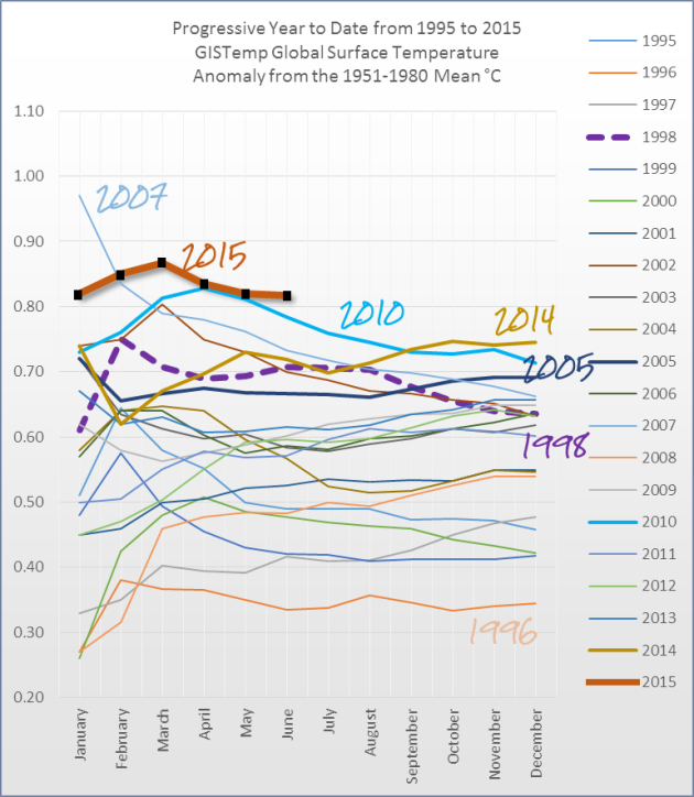
Watching the Global Thermometer – Year to Date GISTemp. 2015 is tracking as the warmest year on record, worldwide, according to HotWhopper. Here’s an excerpt: “…2015 is still tracking as the hottest on record. The years to watch are 2014, 2010 and 2005. I’ve plotted them with slightly thicker lines so they stand out more easily. The coldest year of the lot was 1996, which still ended up more than 0.3°C above the 1950 to 1981 average. The next time someone tries to tell you that “it hasn’t warmed since 1996” then show them this chart :)...”

Heed Climate Change Science Echoed In Call of Faith: Bill Richardson. Here’s an excerpt of an Op-Ed at USA TODAY that got my attention: “…The pope’s very job description gives him access to depths of suffering, spans of time and peaks of human potential that are too vast for most of us to comprehend. So while those of us in less transcendent lines of work squabble about who causes climate change and who should pay for it, Pope Francis cuts through the politics to focus us on what matters most — care for our planet and those most vulnerable to ecological harm…”
* Bill Richardson is the former governor of New Mexico, the Energy Secretary in the Clinton administration, former U.S. ambassador to the United Nations and leader of Voces Verde.

I lived in St Paul in the 90’s. You got me through the 1991 snow storm. It’s nice to find you again.