52 F. maximum temperature yesterday in the Twin Cities. Ouch.
71 F. average high on May 21.
80 F. high in the Twin Cities on May 21, 2016.
May 22, 2011: A strong EF-1 tornado with wind speeds up to 110 mph strikes north Minneapolis, causing extensive tree and structural damage. The tornado touched down in St. Louis Park and moved through north Minneapolis, lasting 14.25 miles before dissipating in Blaine after causing minor damage to the Anoka County Airport. The tornado reached a peak width of 1/2 mile.
May 22, 2001: Record cold high temperatures are set in over 30 cities in Minnesota, including a chilly 47 in the Twin Cities and 39 at Grand Rapids and Pine River. Half of an inch of snow falls at International Falls.
May 22, 1925: Temperatures take a nosedive from 100 to 32 degrees in 36 hours at New Ulm and Tracy.
Can’t Shake a Shower Risk – but Weather Slowly Improves
“Weekends are a bit like rainbows; they look good from a distance but disappear when you get up close to them” wrote John Shirley. Memorial day, summer’s big kick-off, is a week away and my nervous tick is back. For good reason.
According to climatologist Mark Seeley Minnesota’s statewide average rainfall is roughly 30 percent higher now than it was from 1921 to 1950. There’s more water in the air, and it’s coming down harder, especially spring and early summer months.
4 to 6 inches of rain swamped the area last week as a stalled trough of low pressure incubated 3 separate sloppy storms.
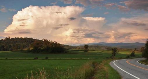
A ‘Sunshine Watch’ has been issued for today. Please don’t stare up at that bright, glowing mystery-orb, but try to enjoy 60s before a few instability thundershowers mushroom to life. Showers spill into Tuesday before improving weather midweek. A warming trend is still brewing – we should top 70F by late week. No more drenching, all-day rains in sight, but a swirl of chilly air aloft may set off weekend showers, especially up north.
Far from perfect, but a definite improvement in the weather.
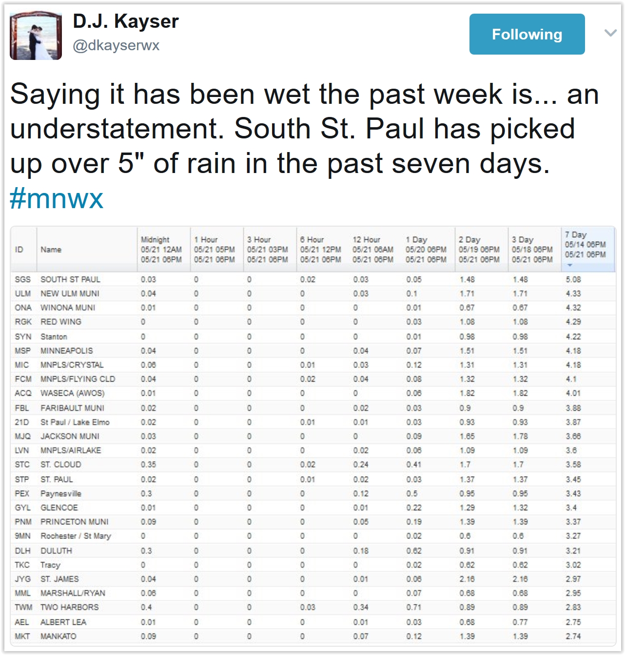
More Than a Month’s Worth of Rain in 7 Days. The coveted Golden Rain Gauge Award goes to South St. Paul, where 5.08″ rain fell since last Monday, according to local observers. The MSP Airport in Richfield picked up a cool 4.18″ of rain with 3.45″ in St. Paul.
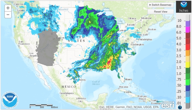
Accumulated Rainfall. 24-hour Doppler radar rainfall estimates are available from NOAA’s AHPS Precipitation Analysis site, along with a wealth of additional information.
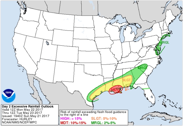
Excessive Rainfall Potential Today. NOAA WPC is outlining an area of southern Louisiana and Mississippi, including New Orleans and Gulfport, for extreme rains capable of sparking flash flooding today; a slight risk of urban flooding from Houston and Shreveport to Birmingham with a marginal risk for the Mid Atlantic region.
Serious Wet Bias East of the Rockies. Check out 84-hour predicted rainfall amounts for the Gulf Coast and Southeastern USA; a streak of 3-6″ amounts forecast from Houston and New Orleans to Atlanta and the Carolinas. The west coast gets a welcome break from puddles in the coming days. Loop: Tropicaltidbits.com.
Sluggish Pattern Increases Flood Risk. When weather systems slow or stall bad things often result. A very slow-moving area of low pressure drags a line of heavy showers and T-storms across the southern USA today, another wave of moisture tracking over the same waterlogged counties by Wednesday. Meanwhile dry, sunny, increasingly warm weather is the rule over the western half of the USA.
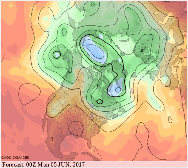
2-Week Weather Darts: Warmer! Confidence levels are low due to an ongoing tendency for the atmosphere over North America to get temporarily locked into a blocking pattern, where weather systems slow or even stall for days on end. GFS guidance hints at a hot ridge of high pressure building over the southern USA, expanding into the Plains and Midwest. We’ll see.
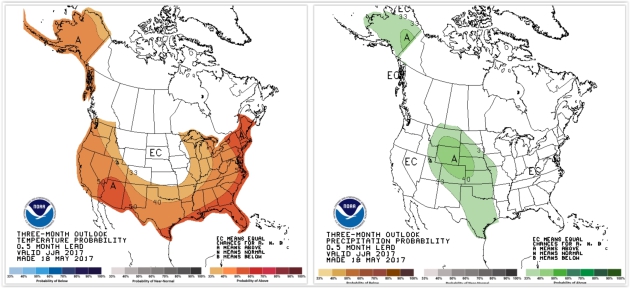
Summer Outlook: Here is the temperature (left) and precipitation outlook for June, July and August, courtesy of NOAA’s Climate Prediction Center. Much of the USA is forecast to experience a warmer-than-average summer, with the exception of the northern Rockies, northern Plains and Upper Mississippi River Valley, where temperatures are forecast to be close to average. A wet bias is predicted from the Rockies into the Plains for meteorological summer.
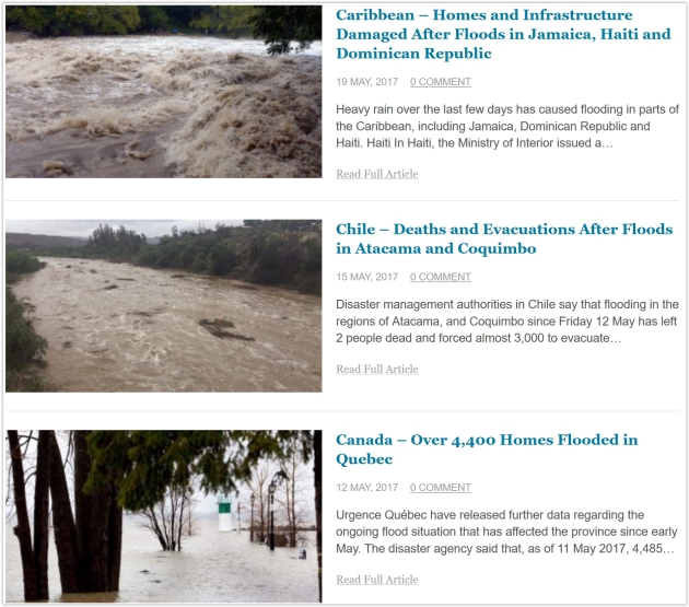
Flooding Overview. Floodlist.com has continuous updates, broken out by continent, related to ongoing flooding episodes around the planet. Here’s an excerpt of a new United Nations report highlighted on the site: “A recent report by the UN, “The Human Cost of Weather Related Disasters”, reveals that in the last 20 years, 157,000 people have died as a result of floods. The report also says that between 1995 and 2015, floods affected 2.3 billion people, which accounts for 56% of all those affected by weather-related disasters – considerably more than any other type of weather-related disaster…”
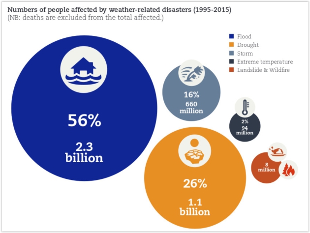
Image credit: UNISDR / CRED.
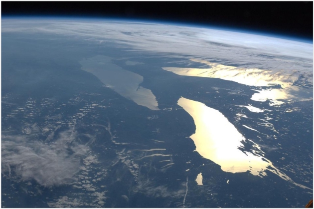
Humans Accidentally Created a Protective Bubble Around Earth. The Atlantic explains our good collective fortune: “The next time someone says you’re living in a bubble, remind them that we all are. A pair of NASA space probes have detected an artificial bubble around Earth that forms when radio communications from the ground interact with high-energy radiation particles in space, the agency announced this week. The bubble forms a protective barrier around Earth, shielding the planet from potentially dangerous space weather, like solar flares and other ejections from the sun. Earth already has its own protective bubble, a magnetosphere stretched by powerful solar winds. The artificial bubble that NASA found is an accident, an unintended result of the interplay between human technology and nature…” (File image: NASA).
Public to EPA on Cutting Regulations: “No!” NPR reports: “As part of President Trump’s executive order to review “job-killing regulations,” the Environmental Protection Agency last month asked for the public’s input on what to streamline or cut. It held a series of open-mic meetings, and set up a website that has now received more than 28,000 comments, many of which urge the agency not to roll back environmental protections. “The EPA saves lives,” wrote Benjamin Kraushaar, who described himself as a hydrologist, hunter and flyfisherman. He wrote that environmental regulations “ensure safe air and water for our future generations. This should not be even up for debate...”
Photo credit: “The Environmental Protection Agency’s flag hangs over EPA headquarters in Washington, D.C.” Bill Clark/CQ-Roll Call Inc.

5 Apps This Road-Tripper Won’t Travel Without. I agree with all 5; here’s an excerpt from Linda Steil at Chrysler Capital: “…I’ve already extolled the virtues of this amazing and free app. When we lived in the city, there were many times it got us around traffic jams, not to mention the help it gave us navigating messy downtown construction. Now that we live in a more country-like setting, I’m still constantly reaching to put my destination in Waze. Even when I know where I’m going, but want to predict an arrival time or tell someone else (another Wazer) when I’ll be meeting them, it’s amazingly accurate, updates real-time and is very simple to use...”
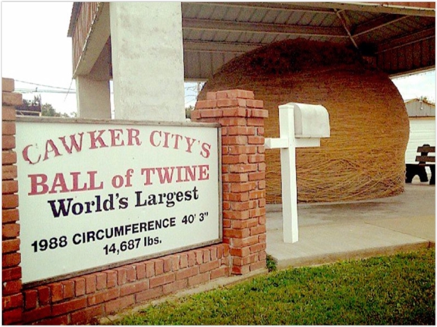
The Worst Tourist Trap in Every State. I disagree with Business Insider’s perspective on MOA, Mall of America in Minnesota. Otherwise the list looks fairly reasonable: “Maybe you’re touring the US as a citizen out to see your homeland. Or maybe you’re coming from afar to see what America has to offer. Either way, you probably want to make the most of your travels. While some tourist spots across the country have become legendary landmarks that everyone should see, others are just disappointing tourist traps. Some are blatant attempts to make money, others are plain weird, but either way, they should be avoided at all costs. Save your time, money, and sanity by skipping these 50 tourist traps...”
Photo credit: “The World’s Largest Ball of Twine in Cawker City, Kansas.” Flickr/Ethan Prater
TODAY: Some sun, PM shower or T-shower. Winds: W 8-13. High: 64
MONDAY NIGHT: Evening shower, then clearing. Low: 47
TUESDAY: Cool and damp, few showers likely. Winds: N 8-13. High: 58
WEDNESDAY: Partly sunny and pleasant. Winds: NE 8-13. Wake-up: 45. High: 61
THURSDAY: Clouds increase, risk of T-shower. Winds: SE 10-15. Wake-up: 43. High: 69
FRIDAY: Mix of clouds and sun, not bad. Winds: SW 8-13. Wake-up: 55. High: 75
SATURDAY: Partly sunny, lukewarm breeze. Winds: NW 8-13. Wake-up: 57. High: 72
SUNDAY: Sunny start, few PM T-showers possible. Winds: NW 8-13. Wake-up: 53. High: near 70
Climate Stories…
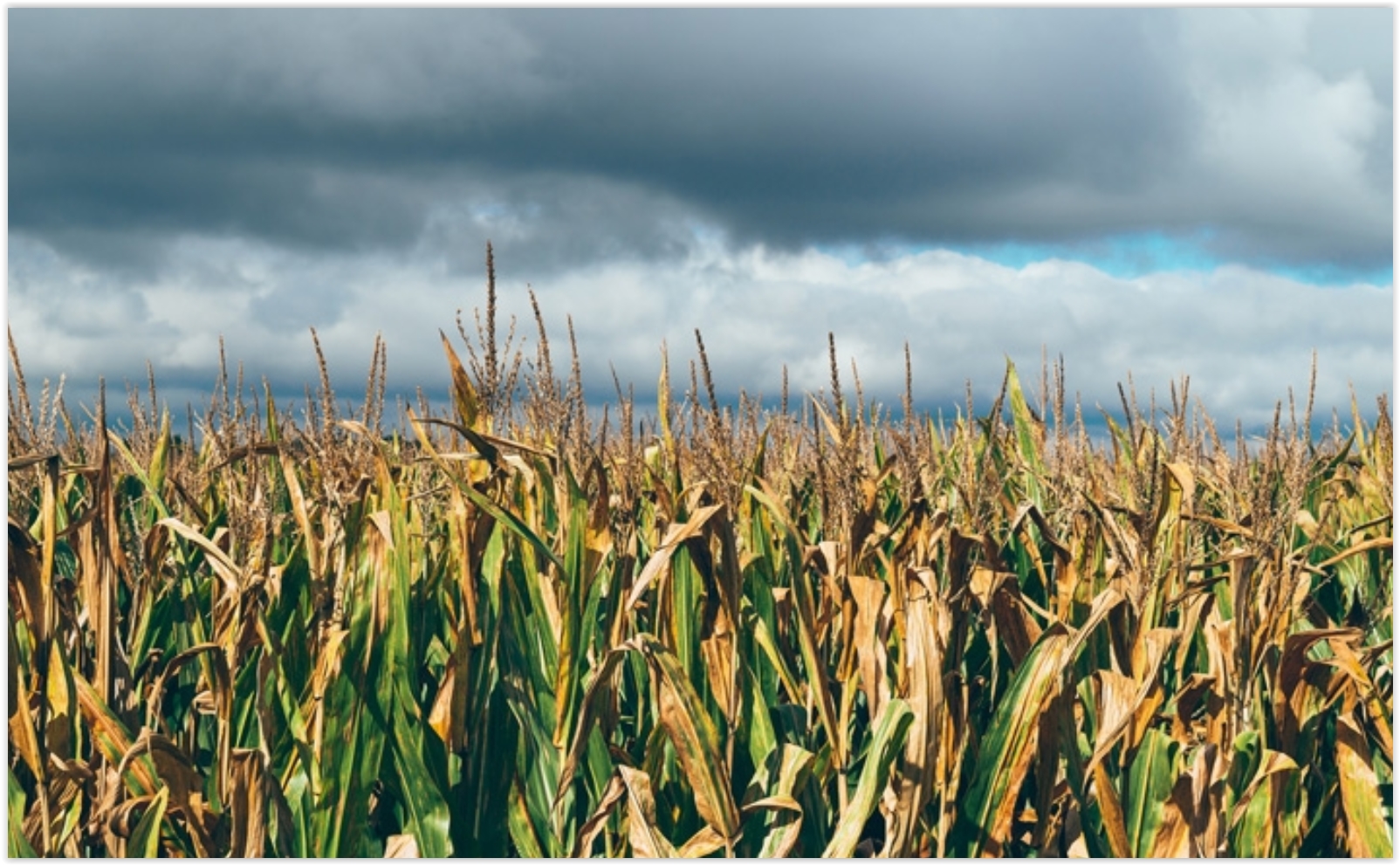
Climate Change Could Slash Staple Crops. CO2 is plant food? Yes, but too CO2 can ruin the recipe. Climate Central explains: “Climate change, and its impacts on extreme weather and temperature swings, is projected to reduce global production of corn, wheat, rice and soybeans by 23 percent in the 2050s, according to a new analysis. The study, which examined price and production of those four major crops from 1961 to 2013, also warns that by the 2030s output could be cut by 9 percent. The findings come as researchers and world leaders continue to warn that food security will become an increasingly difficult problem to tackle in the face of rising temperatures and weather extremes, combining with increasing populations, and volatile food prices. The negative impacts of climate change to farming were pretty much across the board in the new analysis. There were small production gains projected for Russia, Turkey and Ukraine in the 2030s, but by the 2050s, the models “are negative and more pronounced for all countries,” the researchers wrote in the study published this month in the journal Economics of Disasters and Climate Change...”
Photo credit: Andrew Seaman/flickr
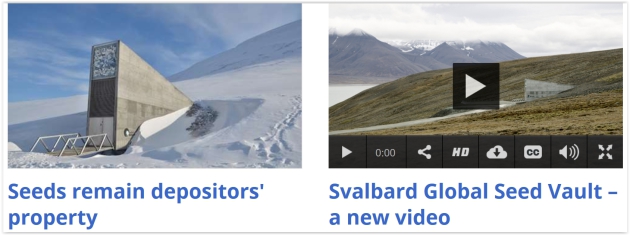
The Arctic Doomsday Seed Vault Flooded. Thanks, Global Warming. Oh the irony. WIRED.com reports: “It was designed as an impregnable deep-freeze to protect the world’s most precious seeds from any global disaster and ensure humanity’s food supply forever. But the Global Seed Vault, buried in a mountain deep inside the Arctic circle, has been breached after global warming produced extraordinary temperatures over the winter, sending meltwater gushing into the entrance tunnel. The vault is on the Norwegian island of Spitsbergen and contains almost a million packets of seeds, each a variety of an important food crop. When it was opened in 2008, the deep permafrost through which the vault was sunk was expected to provide “failsafe” protection against “the challenge of natural or man-made disasters…”
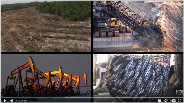
Why Do We Crave the Awful Futures of Apocalyptic Fiction? Aeon Videos has a memorable clip that’s worth a look.
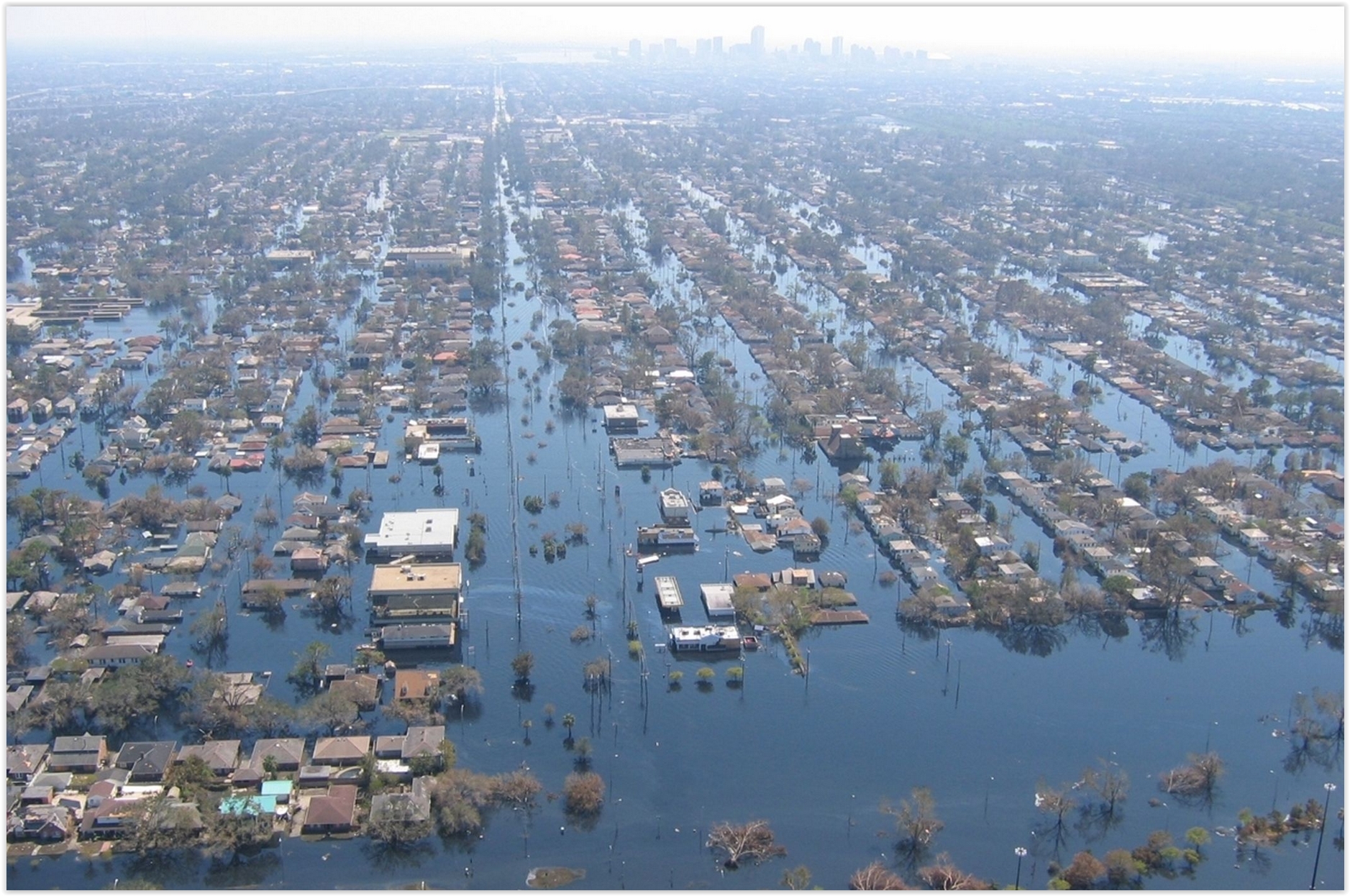
Photo credit: “
