A Comfortable Week – Pondering What Can Go Wrong on the 4th of July
“Life is a long preparation for something that never happens” said Yeats. After a time one learns to embrace dashed expectations.
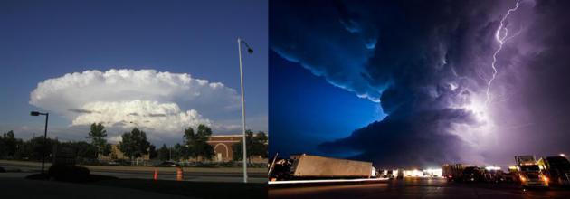
Every year I imagine the 4th of July in Norman Rockwell pastels: kids waving flags, laughter on the lake, a quick family photo in front of the setting sun before the oohs and aahs of fireworks. The reality many years? Running and screaming; chased by vile bugs – or swarms of atmospheric mushroom clouds; lines of flickering storms piled up on the horizon – like some imminent invasion of alien fireflies.
Enjoy comfortable air this week as Canada donates low dew points & fresh breezes with a string of days in the 70s and nights in the 50s. A reinforcing cool front may spark showers Thursday, otherwise its a mainly dry forecast into the 4th of July.
The most comfortable weather of the holiday weekend comes Friday & Saturday (you may need a sweatshirt after dark up north). 80s return Sunday and the 4th of July; ECMWF guidance hinting that storms may hold off until next Tuesday as 90s return.
In fact long-range models hint a streak of 90s by mid-July.
Touch of mid-September in late-June. Highs hold in the 70s this week, about 5-8F cooler than average. Nights will be in the 50s, even some (rare) 40s up north later this week. ECMWF guidance shows warming next weekend; low to mid 80s by the 4th of July in the Twin Cities. Graphic: WeatherBell.
Growing Chance of (Real) Heat by mid-July. We got a taste on Saturday with 96F in the Twin Cities and a heat index in the low 100s – odds are it got your attention. If long-range GFS forecasts verify the heat-pump high over the western USA may finally expand north and east within 10-14 days. A string of 90s across much of Minnesota by mid-July? We’ll see.
Trickle-Down Technology. A race to space following launch of The Soviet Union’s Sputnik satellite in 1957 had a Cold War weather dividend: “Tiros-1” began sending back grainy weather imagery from low Earth orbit in 1960. Radar operators tracking enemy planes during WW II noticed smudges of interference on their screens. They thought it was a bug – turns out they were seeing precipitation, not German aircraft; a happy discovery that has evolved into today’s high resolution Doppler radar.
Trooper: Flood-Damaged West Virginia “Looks Like a War Zone”. Here’s an excerpt from CBS News: “…It looks like a war zone when you go inside these houses,” State Trooper C.S. Hartman told CBS News. He worried that among the destruction will be more bodies. “That’s the last thing I want to do, but we’re prepared for it,” Hartman said. The once-a-century flood left the small town of Clendenin mostly underwater. Forty-four of West Virginia’s 55 counties were inundated. The National Guard and FEMA have been called in to help. Thousands are without power. At least 100 homes suffered significant damage or were destroyed…”
Photo credit: “West Virginia State Trooper C.S. Hartman uses a boat to navigate the flooded streets of Rainelle, W. Va., on Saturday, June 25, 2016.” CBS News.
What It Might Take to Protect the World’s Biggest Naval Base From Rising Seas. PRI, Public Radio International, takes a look at the vulnerability of the Tidewater region to the 1-2 punch of rising seas and land subsidence, with impacts already observed by the U.S. Navy: “…Norfolk is the home port for the cruisers, destroyers and battleships of the Atlantic Fleet. Rising sea levels and increasing storm surges there are already having an impact on military readiness. “It’s not the boats that are the issue, they’re designed to be in water,” said Captain Pat Rios, who until May was the head engineer for the Navy’s mid-Atlantic region. “The issue with sea-level rise is less about the ship, it’s more about the system that supports the ship.” That system sits on more than 6,000 acres in Norfolk, on a point of land in southern Virginia near where the Chesapeake Bay meets the Atlantic Ocean…”
Photo credit: “Naval Station Norfolk may experience as much as six feet of relative sea-level rise by the end of the century. Defense officials are beginning to work with nearby city governments to ensure vital infrastructure is protected.” Credit: Navy handout obtained by Reuters in 2013.
TUESDAY: Hints of September. Bright sunshine, less wind. Winds: NW 3-8. High: 76
WEDNESDAY: Partly sunny and milder. Winds: S 7-12. Wake-up: 61. High: 80
THURSDAY: Showers likely, possible thunder. Winds: N 8-13. Wake-up: 64. High: 78
FRIDAY: Sunny, comfortably cool. Winds: E 5-10. Wake-up: 57. High: 75
SATURDAY: Blue sky, low dew points (50s). Winds: SE 7-12. Wake-up: 56. High: 79
SUNDAY: Sunny, warmer for lake stuff. Winds: SE 10-20. Wake-up: 58. High: 82


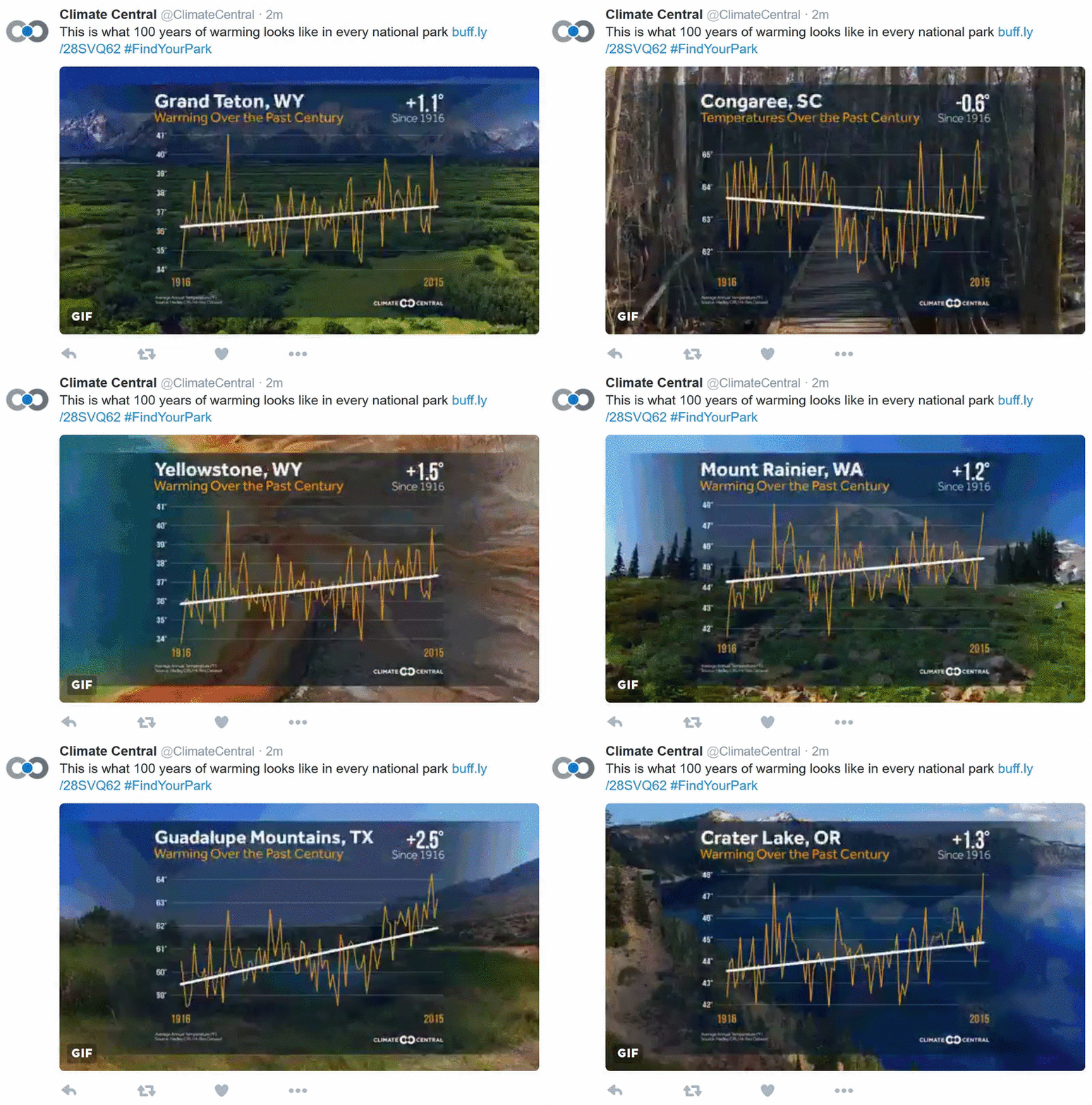
Climate Change is the National Parks’ Biggest Challenge. Climate Central takes a look at new challenges within “America’s Best Ideas”, our parks: “…Rising temperatures, an increase in extreme dry years and disappearing snowpack are altering the conditions that have allowed these trees to thrive for eons in a thin band along the Sierras’ western flank. The ongoing California drought has hit the southern Sierras hard and increased the risk of more destructive wildfires, and less water availability in the summer. Researchers have already documented a dieback in older trees during the drought, one of the many “a-ha moments” that point toward future challenges for the Giant Forest. The average annual temperatures in the park are projected to rise around 7°F by 2100 if carbon pollution isn’t slowed, further disrupting a delicate balance...”

