April 27, 2002: Heavy snow falls over the Twin Cities and central Minnesota. Chanhassen receives 6 inches, and vivid lightning is seen with the snow during the evening.
April 27, 1996: Embarrass records a low of 9 degrees. Some central, and most northern, Minnesota lakes are still ice-covered.
April 27, 1921: A late season blizzard hits Hibbing. The temperature was 75 degrees three days earlier.
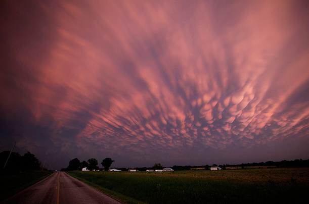
Tornado Lotto: When To Pay Extra-Close Attention
Xenia. Greensburg. Joplin. Tuscaloosa. Fridley. All towns leveled by large, violent tornadoes. Every spring an unholy meteorological lotto plays out on the Plains. Most of us are spared, but a few cities are decimated.
The next 4-8 weeks are, historically, most violent. Why? The ground is warming rapidly, yet the upper atmosphere is suffering from a wintry hangover. Extreme instability, along with Gulf moisture and wind shear create a ripe environment for “supercell” storms.
Things to watch for: large hail is often a precursor. A PDS (particularly dangerous situation) tornado watch is a clue you’re not dealing with garden-variety storms. A “Tornado Emergency” is one step above a tornado warning, implying a confirmed tornado on the ground. In spite of high tech there’s still no substitute for common sense.
Don’t complain about a chilly week. The storm that spawned big tornadoes yesterday tracks to our south, keeping us on the stable (safe) northern edge of the system. Up to 1 inch of rain falls tonight into Thursday; even more over far southern Minnesota.
Enjoy the cool front; 80F is possible the first weekend of May!
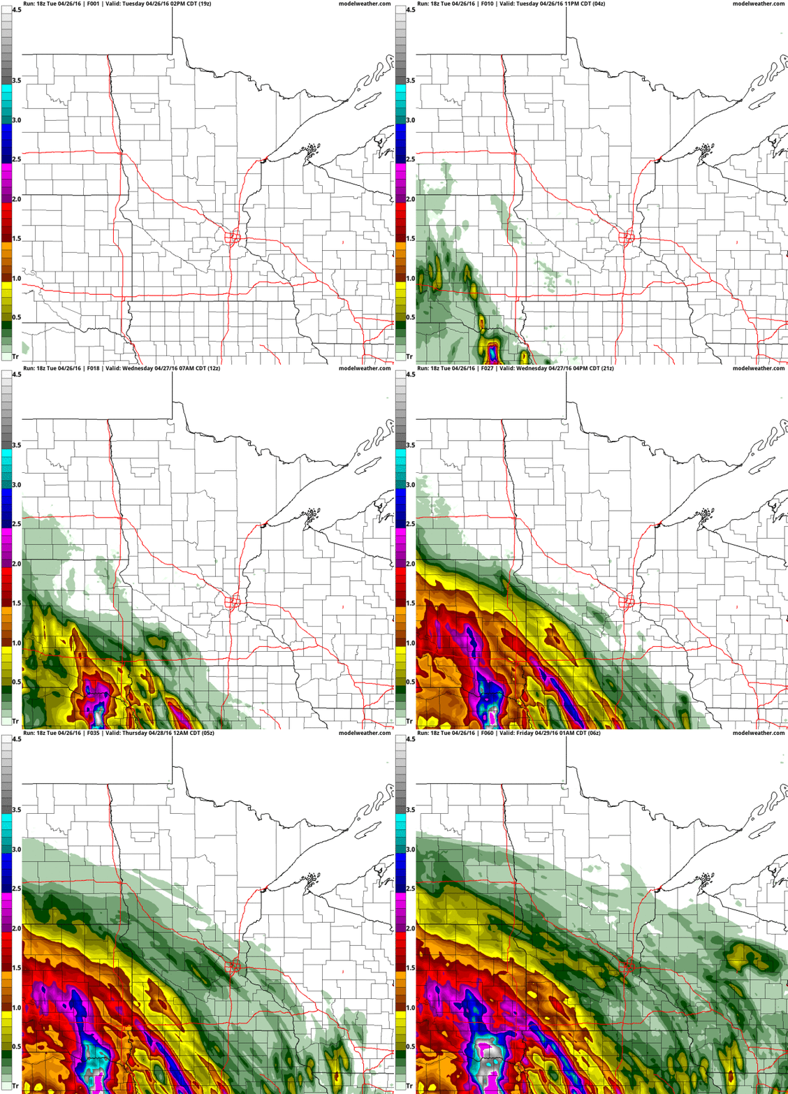
Heaviest Rains Pass South. The same system that sparked severe weather across the central and southern Plains Tuesday will push a shield of moderate to heavy rain into the Midwest with as much as 2-3″ of rain near Sioux Falls. 00z NAM guidance prints out .54″ of rain for MSP; amounts drop off rapidly as you head north of the Twin Cities. 60-hour 4KM NAM guidance: NOAA and AerisWeather.
Too Cool for Tornadoes. My lame attempt at spinning a cool, damp, showery pattern into Saturday. 60s return early next week; 70s by the end of next week. Yes, spring returns in all its glory within 3-5 days. Source: WeatherSpark.
Warming Trend into mid-May. 500 mb guidance looking out 2 weeks (GFS) forecasts an expanding ridge of high pressure from the Plains into central Canada, suggesting warmer than average weather for the second week of May, while New England stays unusually chilly with more rain (and snow) showers.
Sweatshirts and Shorts. Proving once again that spring is the most fickle of seasons, light jackets give way to shorts and T-shirts within a week or so; a shot at 80F during the first weekend of May. GFS forecast for MSP courtesy of NOAA.
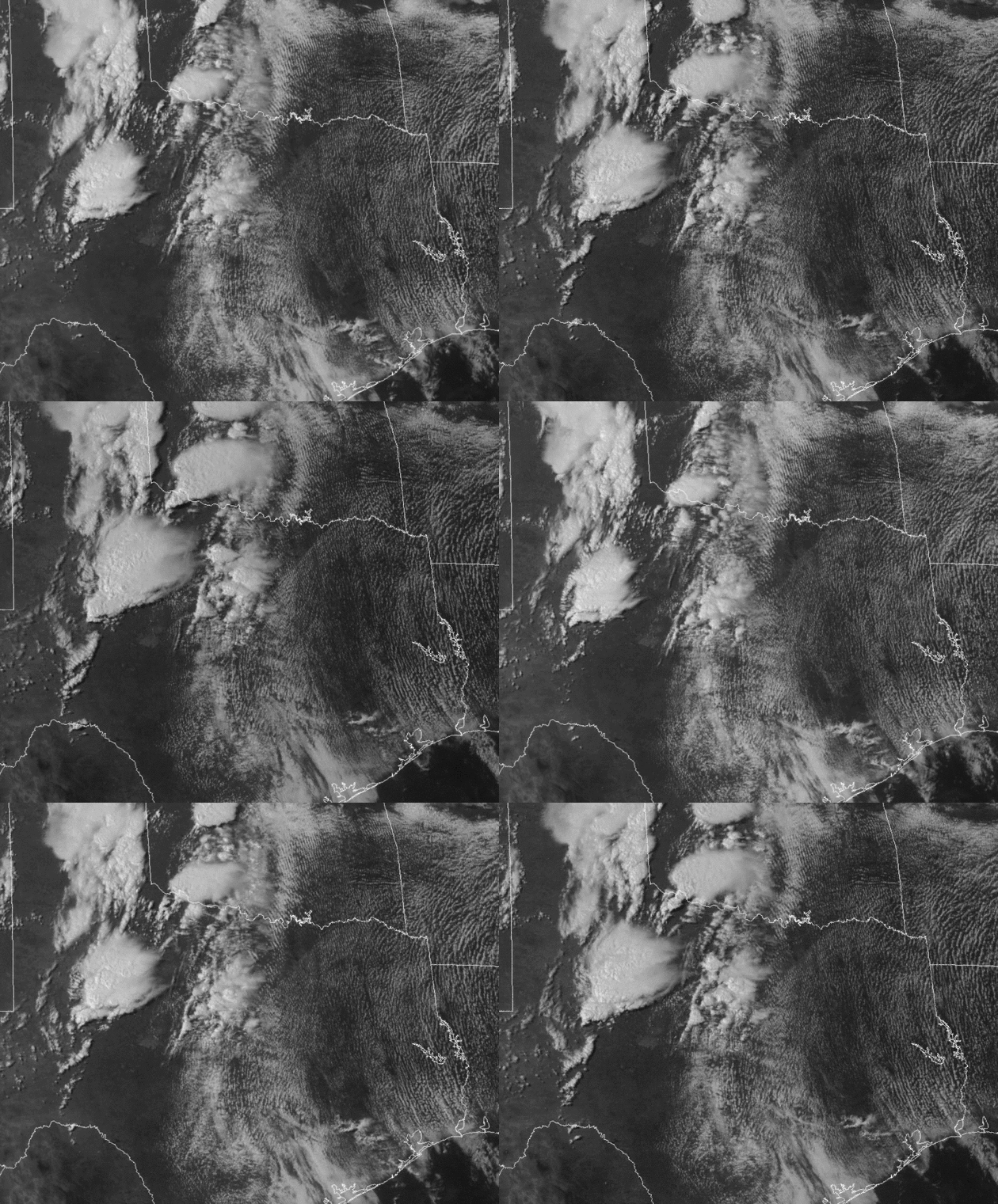
1 Minute Visible Updates. Talk about hypnotic – here is a loop from NOAA’s new GOES-14 (GOES-R) satellite, where images are snapped once every 60 seconds, creating a smooth, fluid satellite loop that captures features unseen until now. This animation was recorded around 5 PM yesterday as tornadic T-storms were firing up along a dry line in western Texas and Oklahoma. Credit: RAMMB, Colorado State.
Storm Chasers Look Back on Deadly (Tuscaloosa) Tornado. A monstrous EF-4 struck Tuscaloosa 5 years ago today; here’s an excerpt of a perspective from local storm chasers at al.com: “…Five years later, Chandler would do it again. Not for the adrenaline, although he felt it. Ill-advised as it was, the chase changed his life. And not because the “F5 Tuscaloosa tornado” video Hughett filmed and Chandler posted went viral, currently boasting 3.4 million views on YouTube. The chase gave Chandler a new purpose in life, not as a budding storm-chaser, but as public servant. The Tuscaloosa native now works as a firefighter in Tennessee, a career he’d soon pursue in the immediate aftermath of what happened in the afternoon of April 27, 2011. Now a historic document, the video marks a crucial moment the city’s history, chronicling 13 of the most dire and challenging minutes in one of Tuscaloosa’s darkest and subsequently proudest hours...”
* The raw tornado chaser video is here (rated PG for salty language). No wonder it has 3.5 million views on YouTube – it’s amazing.
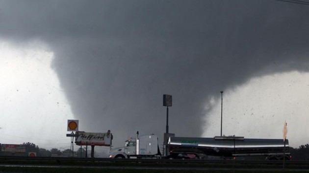
A Tornado’s Heading Your Way. Now What? Are there ever circumstances where tryinig to drive away from a tornado makes sense? It’s a tough question, but if it’s an EF-4 or EF-5 and you don’t have a basement, the tornado may not be survivable. Here’s an excerpt from CNN: “…My advice would be to seek the safest place available. That is: lie in a ditch or … (get) behind a heavy object if you had a tractor or even a tree.” He cited the 1979 Wichita Falls, Texas, tornado as a cautionary lesson. That twister killed 54 people and, Kiesling noted, “many people were killed in automobiles because they tried to outrun it.” Still, Kiesling allowed, there may be times when fleeing an impending tornado might be a good option. “If you have good information on the storm, if you have plenty of warning, if you have an automobile, it may make sense, but I personally don’t feel that’s the advice that we want to give the public...”
Two Reasons Why We Have To Stop Throwing Around the Phrase “Wedge Tornado”. I couldn’t agree more. Here’s a snippet from Capital Weather Gang: “…While width is not a measure of strength (I’ve seen an EF-1 wedge tornado in Kansas), it is true that the widest tornadoes tend to be strong. From 0.25 miles up to one mile wide, we find 69 percent of 0.25 mile wide tornadoes were rated F/EF-2 (strong) or greater and 87 percent made that classification at 1 mile wide. Given their scare appeal, it is understandable that wedge tornadoes are feared and widely reported. Additionally, many of the great tornado disasters of our time — think Joplin (2011) or Greensburg (2007) — have been caused by wedge tornadoes...”
Map credit: SPC, Ian Livingston, Capital Weather Gang.
Tornado Warnings Get Minds Spinning. Can longer warnings (up to an hour) trigger behavior more likely to get people injured and killed? Quite possibly. Here’s an excerpt from The Denver Post: “…For all of their advances in the physical sciences, forecasters have yet to determine when advance warnings are most effective and how urgent their messages should be. They worry about the “cry wolf” syndrome, in which people may tune them out, and about people overreacting, especially with tornadoes. People have left much safer buildings and headed into their cars to flee, but cars are the last place you want to be in a tornado. And it’s not just tornadoes. Forecasters are still trying to understand why several people in Houston ignored the mantra “Turn around, don’t drown” and died after driving onto flooded streets last week...”
Why Modern Meteorologists Use a 19th Century Crystal Ball. I did not know this – here’s an excerpt of interesting triva at Atlas Obscura: “It sounds like the premise for a riddle: At the South Pole are two crystal balls that provides unfailingly accurate information—not about the future, but about the past. This is no trick. It’s just meteorology. The dual glass spheres at the South Pole are Campbell-Stokes sunshine recorders, orbs that capture the number of hours of direct sunlight each day, as well as its intensity...”
Photo credit above: “A Campbell-Stokes sunshine recorder in Antarctica“. (Photo: Akulovz/CC BY-SA 4.0).
U.S. Wind Power Jobs Hit Record High, Up 20% in 2016. Clean Technica has an update – here’s the intro to a recent story: “The US wind power industry reached a record job high of 88,000 jobs at the start of 2016, up 20% in the space of a year. According to a new report from the American Wind Energy Association (AWEA), the American wind power industry supported a record 88,000 jobs at the start of 2016, an increase of 20% over 2015. The report, US Wind Industry Annual Market Report, Year Ending 2015, heralded the strong job growth in the sector with the recent news that wind topped new energy capacity in the US in 2015…”
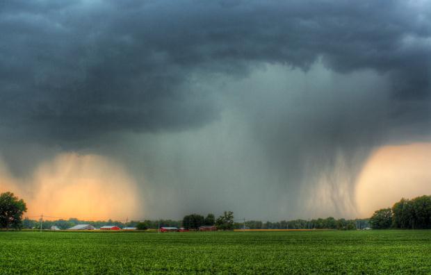
THURSDAY: Soggy. Rain tapers to showers. Winds: NE 10-20. High: 50
FRIDAY: More clouds than sun, drier. Winds: NE 8-13. Wake-up: 42. High: 58
SATURDAY: Dry start, PM showers possible. Winds: E 15-25. Wake-up: 47. High: near 60
SUNDAY: Damp start, drier day of the weekend. Winds: E 10-15. Wake-up: 46. High: 62
MONDAY: Partly sunny, less wind. Winds: NE 7-12. Wake-up: 45. High: 64
TUESDAY: Plenty of sunshine, pleasant. Winds: SW 8-13. Wake-up: 44. High: 67
Climate Stories…
The Math the Planet Relies on Isn’t Adding Up Right Now. The warming is taking place faster than those “alarmist climate models” have been predicting. Chris Mooney reports at The Washington Post: “As over 150 nations assemble to sign the Paris climate agreement in New York on Friday, reams of new analysis are pouring out from the planet’s vital number-crunchers, who look at the fundamental relationship between how much carbon we put in the air and how much the planet’s temperature increases as a result. And it’s adding up to a somber verdict: We seem closer to must-avoid climate thresholds than we thought — and crossing them may have bigger consequences than we recognize…”
Image credit: Planetary Visions LTD.
Why Fighting Climate Change Won’t Destroy the Economy. Threat, and opportunity for renewal, resilience and reinvention. Here’s an excerpt from The Desert Sun: “As the reality of human-caused climate change has become harder to deny, opponents of climate action have adopted a new talking point. Replacing fossil fuels with clean energy, they say, would devastate the American economy, sending electricity prices through the roof, forcing people to abandon their cars and putting millions of people out of work. There’s one problem: Researchers who have studied the clean energy transition disagree. Reducing greenhouse gas emissions wouldn’t have the dire economic consequences critics have predicted, several comprehensive studies have found. On the contrary, experts say, dramatic action to slash carbon emissions would be relatively inexpensive, if not a money-saver — and that’s without accounting for the long-term benefits of avoiding catastrophic climate change...”
The Arctic Is Melting, and Researchers Just Lost a Key Tool to Observe It. The Chicago Tribune has the story; here’s the intro: “Earlier this month, a U.S. satellite known as F17 – which was primarily used for meteorological measurements – experienced operational failures that compromised the integrity of its data. And while there are similar satellites in orbit that can take over the data collection for now, they’re old enough that scientists are unsure how much longer they’ll last. Now, with no government plans to launch a replacement any time soon, scientists who rely on these satellites for valuable climate data are beginning to worry about the future of their research. The problem comes at a vital time, too – one when the Arctic, and other remote regions, are seeing rapid changes and scientists badly need these instruments to track them…”
Image credit above: “This image provided by NASA shows Arctic sea ice at it maximum, the lowest on record. The winter maximum level of Arctic sea ice shrank to the smallest on record, thanks to extraordinarily warm temperatures, federal scientists said.” (AP)
Saudi Arabia Plans for Life After Oil. Bloomberg has the story.
Climate Scientists are Now Grading Science Journalism. Here’s a clip from The Guardian: “…Climate Feedback intends to change that. It brings together a global network of scientists who use a new web-annotation platform to provide feedback on climate change reporting. Their comments, which bring context and insights from the latest research, and point out factual and logical errors where they exist, remain layered over the target article in the public domain. You can read them for yourself, right in your browser. The scientists also provide a score on a five-point scale to let you know whether the article is consistent with the science. For the first time, Climate Feedback allows you to check whether you can trust the latest breaking story on climate change…”

