31 F. high in the Twin Cities yesterday.
25 F. average high on January 28. That’s up one degree; average temperatures finally creeping upward.
0 F. high on January 28, 2014 after waking to -16 F.
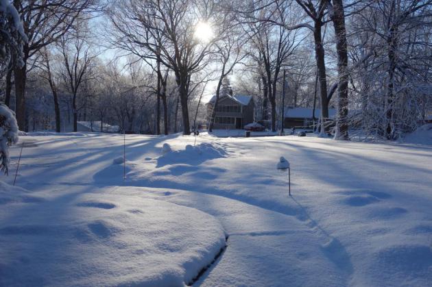
Trace of snow on the ground in the Twin Cities.
January 28, 1977: Due to the extreme cold, the St. Paul Winter Carnival was held indoors for the first time.
What January?
A year ago meteorologists were hyping the Polar Vortex; jet stream winds buckling and stalling, allowing arctic air to overstay its welcome. This year: more of a Pacific influence, fewer subzero flings, January temperatures about 3F milder than average.
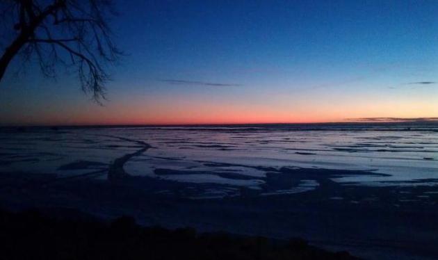
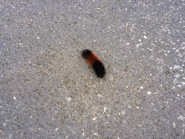
David Young wrote me a note, describing a harrowing plunge into Lake of The Isles Sunday. Unstable ice in late January? Always an issue for spring-fed lakes and river currents, but falling through the ice in January, in Minnesota, requires a fair amount of effort. Jason Torgerson sent a photo of caterpillars in Shoreview.
Chirping robins, canceled pond hockey games, where does it end?
I’m here to (gently) remind you that Canada won’t run out of cold air anytime soon. I’m predicting a minor reality readjustment, with teens early next week, an even colder front the end of next week with a few single digit days – maybe a couple nights below zero. But still not as cold as the first 10 days of January.
Call me crazy but I suspect the coldest days are behind us.
I see scrawny clippers into mid-February. At some point we’ll see a legitimate storm. But as farmers like to say “When in a drought don’t forecast rain.”
Or snow for that matter.
Blizzard-Free. At least for a few days. The next clipper pushes snow showers across the Great Lakes into New England, a southern system dropping a few inches of snow on the mountains of New Mexico by Saturday morning. 60-hour 4 km NAM snowfall potential courtesy of Aeris Weather.
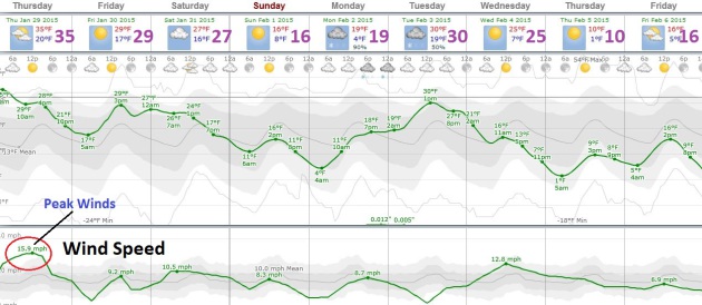
Reality Readjustment. Although not as cold as early January there’s little doubt we’ll see a temperature tumble early next week, an even colder slap the end of next week. A few clippers swept up in a northwest flow may coat the ground, but (amazingly) not significant snow is in sight. Graphic: Weatherspark.
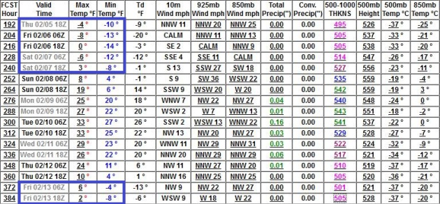
Mixed Signals. The latest output from NOAA’s GFS model shows a thaw by the second week of February, followed by more arctic air by mid-month. With a higher sun angle it gets increasingly difficult to experience subzero weather, especially subzero daytime highs. I’m still not convinced it will get as cold as the first 10 days of January.
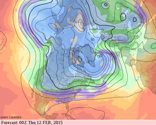
Colder Phase. After a brief thaw around February 10 temperatures tumble again by the middle of next month; the core of the jet stream continuing to whisk the biggest, wettest storms south and east of Minnesota as far ahead as I dare look (about 2-3 weeks). Source: GrADS:COLA/IGES.
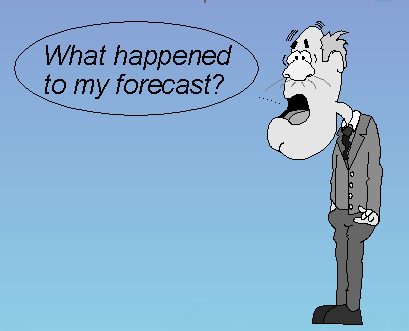
What Happened To The Blizzard of 2015? Wait, there was a blizzard? I had no idea. Greg Laden has an interesting post at scienceblogs.com; here’s an excerpt: “…More importantly, the forecast was for a huge blizzard with up to three feet of snow across a blob shaped region of the Northeast approximately 475 miles along its longest dimension (see graphic above). The blob ended up being off, on the southwest end, by about 40 or 50 miles. So the spatial extent of the storm was misestimated, days in advance, by about 10%. An object the size of a country was off by the distance a healthy adult can walk in a long day. That was, ladies and gentleman, an excellent, accurate prediction…”
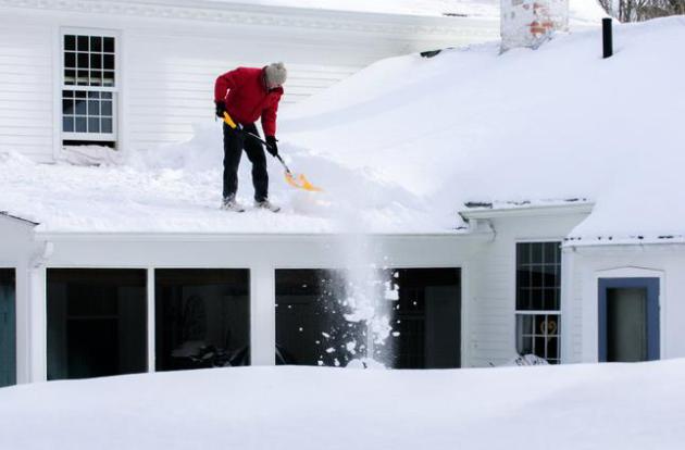
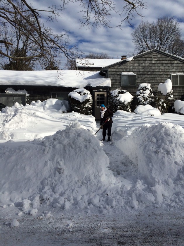
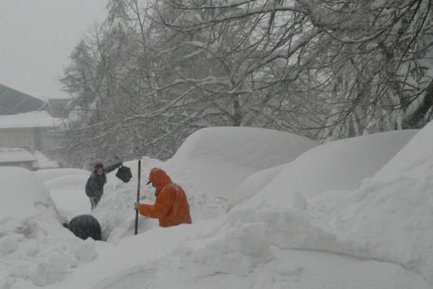
Photo credit above: “Bruce Raymond shovels snow from the roof of his Chaplin, Conn. home on Jan. 28, 2015, after yesterday’s storm that brought more than 20-inches to parts of the state. More snow and freezing temperatures are forecast for most of next week.” (Mark Mirko/Hartford Courant/TNS).
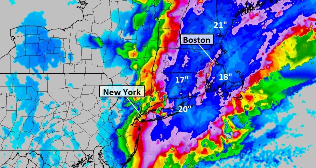
Why The Forecasters Got It So Wrong For New York City. Bloomberg takes a look at dueling models, and how all the models (sucked) for New York City’s snowfall totals; here’s an excerpt: “…Everyone went with the Euro and it was wrong,” Carolan said. “This winter the Euro hasn’t been the model it has been in the last two winters.” While the GFS, which was upgraded earlier this month, did a better job forecasting how the storm played out, another U.S. model also erred on large snowfall amounts, Uccellini said. “Our own NAM model was right there with the European Centre,” he said…” (Image: Aeris Weather).
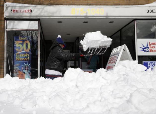
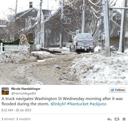
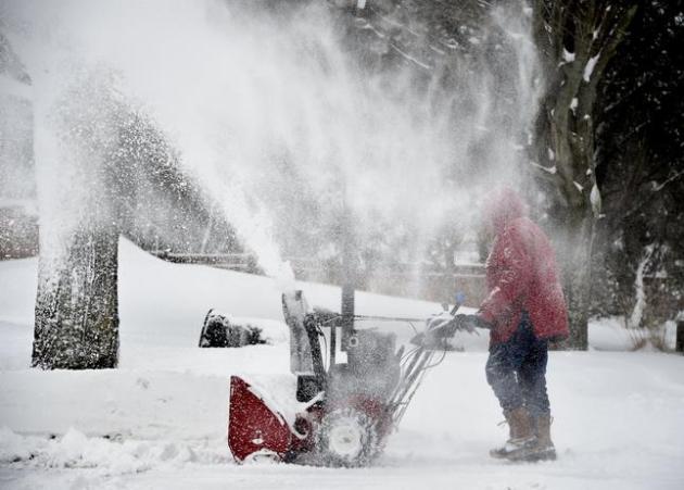
Photo credit above: “Snow swirls into the air as Ted Diamond operates a snow blower to clear out his driveway on Greenvale Drive in East Northport on Tuesday, Jan. 27, 2015, in New York. Long Island was one of several areas throughout the state to be hit by a blizzard overnight into this morning.” (AP Photo/Kathy Kmonicek).
Partly Wrong With A Chance of Being Right: Weather Forecast. Why do weather models fail? In light of the Big Bust out east I wanted to include a link to a storyy at ScienceDaily; here’s an excerpt: “…For example, they found that in the eastern Mediterranean, particles in the atmosphere were the most important cause of forecast fallacies, followed by land cover change. They also found topography to be the most influential factor affecting weather around the world. “The only tool the weather forecaster has is his model, and the only choice he or she has is to look at different models, each of which has strengths and weaknesses,” said Prof. Alpert…”
Snow Scary. The New Yorker has a terrific article that helps to explain why the USA is a nation of extreme-weather junkies; here’s a clip: “…Edgework” is precisely what extreme weather is. A winter storm—or any storm, really—approximates this thrill. It’s powerful, and even dangerous. But safely ensconced inside, and in front of our computer screens, we don’t think that it will really hurt us. The power might go out, but then we would be able to share a picture of a car buried in a snowdrift. And then, soon, it will be over. You will have had the thrill, and you might have gained control over it by capturing a moment of “danger,” but, in all, it seems a relatively minor risk. We satisfy our inner risk-seeker without going into dangerous territory…”
The Adult Snow Day Is Dying, And That’s Sad. Amen. New York Magazine has the essay; here’s a snippet: “…The grown-up world has a tendency to strip things of their magic a bit, but the snow day still served as a wonderful stop sign from the heavens for myopic, overworked adults. What else could grind to a halt, even temporarily, the exhausting, striving adult world of meetings and reports and office memos? What else could not only suggest to the workaholic that he take a day off, but force him to because the roads were too icy, the subways all closed? What else could unite father and son on a sled on a snowy hill in the middle of a weekday?…”
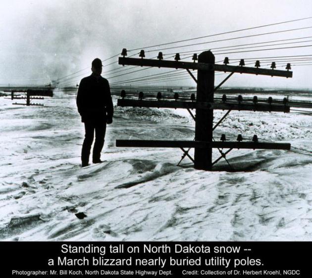
7 Chilling Stories Of Snow Storms Throughout American History. TIME Magazine takes a numbing walk down memory lane; here’s a clip: “…It was Jan. 31, 1977, when this poor freezing man appeared on the cover of TIME. The story inside, which detailed the effects on the United States of what the publisher’s letter called “the bitterest cold spell in memory.” The first-ever reported snow fall in West Palm Beat, Fla., had shocked residents. Buffalo had been buried under more than 120 in. of the white stuff that season. And, ironically, areas that needed snow — the ski resorts of Idaho, for example — had to rely on snow-making machines despite the cold temperatures…
Photo credit: Bill Koch, North Dakota State Highway Department. Credit: Collection of Fr. Herbert Kroehl, NGDC.
“Snowstorms Then And Now“. McSweeney’s Internet Tendency has a look at how adults have ruined snowstorms. It’s a worthy (and funny) read.
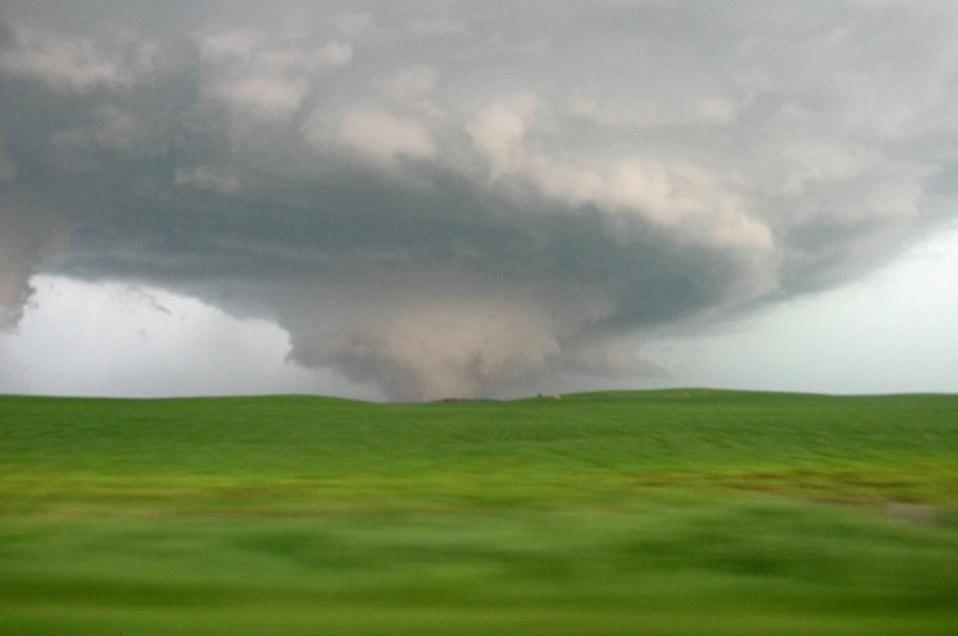
Central American Fires May Intensify U.S. Tornadoes. Really? Science News has an overview on how smoke can amplify conditions necessary for tornadoes, which I found to be non-obvious; here’s a clip: “…Smoke wafting across the Gulf of Mexico from Central America can help spawn intense twisters in and around North America’s Tornado Alley, new research suggests. Reconstructing the extreme April 27, 2011 tornado outbreak, which sired 122 twisters across the Southeastern United States, researchers found that smoke particles in the atmosphere further enhanced conditions already favorable for intense tornado formation...”
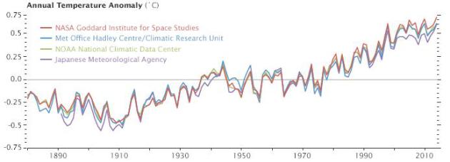
Why So Many Global Temperature Records? NASA Earth Observatory has a good explainer focused on 2014 being the warmest year ever observed, as well as providing perspective of recent trends; here’s a clip: “…But let’s get back to the original question: why are there so many temperature records? One of the hallmarks of good science is that observations should be independently confirmed by separate research groups using separate methods when possible. And in the case of global temperatures, that’s exactly what is happening. Despite some differences in the year-to-year rankings, the trends observed by all the groups are roughly the same. They all show warming. They all find the most recent decade to be warmer than previous decades...”
Is It OK To Eat Snow? I know this has been on your mind; here’s an answer from Popular Science: “…Once the snow is on the ground, it stays clean until other things land on top of it. Everyone knows you shouldn’t eat yellow snow. Brown snow is off limits, too. That’s because as snow sits around, it goes through a process called dry deposition, in which dust and dirt particles stick to the snow. And Nolin says to steer clear of watermelon snow: It might look pretty and very pink, but it’s filled with algae that don’t do great things for digestion…”
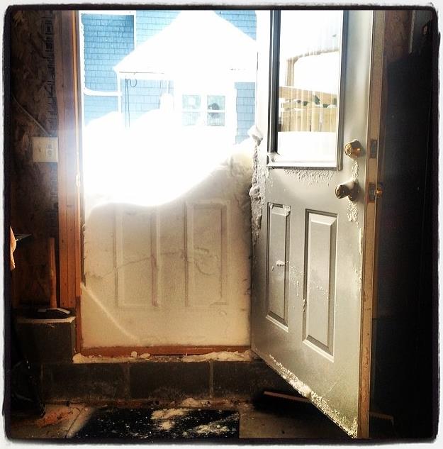
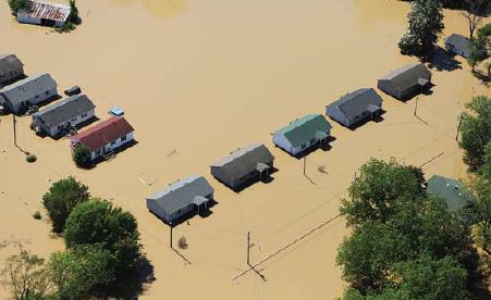
So THIS Is What Winter Looks Like. Thanks to Leslie Corris in Newton, Mass. – just west of Boston, for reminding all of us that winter often brings heavy snow. Newton picked up about 20″ of snow, some 30″ amounts in a few Boston suburbs. For the record, Boston received, in one snowfall, as much snow as the Twin Cities has picked up all winter (20.4″ so far). Good grief.
Paul,
More of an observation…I was out for a noon-time walk on Tuesday, Jan 27, near Rice Creek Parkway in Shoreview, when I spotted this little fellow walking alongside me. Air temp was about 35 F, and he was definitely moving (albeit very slowly).
I don’t recall ever seeing a live caterpillar in the middle of winter before.
– Jason Torgerson
TODAY: Cloudy, windy, cooler. Winds: NW 15-25. High: 31
THURSDAY NIGHT: Gusty and colder. Low: 12
FRIDAY: Chilled sunshine, less wind. High: 27
SATURDAY: Mix of clouds and sun, dry. Wake-up: 16. High: 28
SUNDAY: Some sun, deflated temperatures. Wake-up: 8. High: 16
MONDAY: Sunny start, clouds increase. Wake-up: 3. High: 19
TUESDAY: Early coating, then clearing. Wake-up: 15. High: 29
WEDNESDAY: Sunny peeks, a colder swipe arrives. Wake-up: 14. High: 17
Climate Stories…
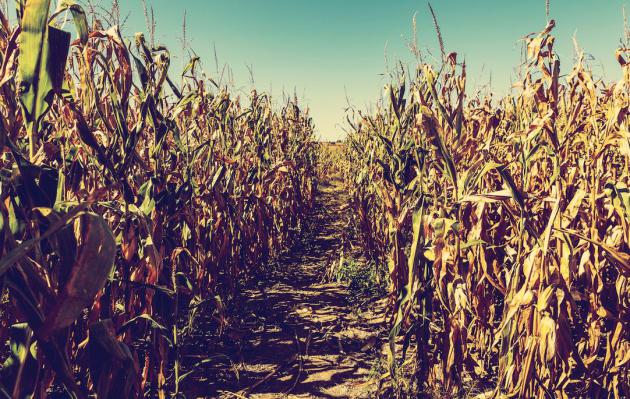
Corn Belt Farming Boosts The Global Carbon Cycle. I thought this was interesting, a snippet of a story at KCUR.org: “…Scientists have noticed a change in the atmosphere. Plants are taking in more carbon dioxide during the growing season and giving off more carbon in the fall and winter. Recent research shows the massive corn crop in the Corn Belt may be contributing to that deeper breath. It comes down to the Carbon Cycle. Over the winter when corn fields lay dormant, corn stalks and roots break down, sending CO2 into the air. Then in the summer when a new crop is growing, it takes up carbon from the atmosphere…”
Yes, We Can Live Well And Avoid Climate Disaster, Says UK Government. The Guardian has the story; here’s an excerpt: “…Dealing with greenhouse gas emissions will require a transformation of electricity generation, including an expansion of renewable energy and nuclear power, as well as more public transport and changes to the built environment, according to the key findings of the Global Calculator, an online software tool developed by the Department of Energy and Climate Change (Decc), with partners. The calculator is intended to show the likely outcomes of a variety of choices that policymakers and the public can make to tackle global warming, such as investing in nuclear, insulating houses, making electrical appliances more efficient and using electric vehicles…” (Image: FEMA).
What A Warming World Means For Major Snowstorms. Warmer air and ocean water has already resulted in an increase in water vapor, more fuel for flash floods in summer, and higher snowfall amounts in winter. Here’s a clip from Quartz: “…About half of the current anomalous ocean warmth, and therefore the enhanced moisture, can be attributed to climate change, Trenberth said. As the oceans and atmosphere warm due to the buildup of heat-trapping greenhouse gases, that moisture source could continue to grow, to the tune of 4% more water vapor in the atmosphere for every 1 °F rise in global temperatures…”
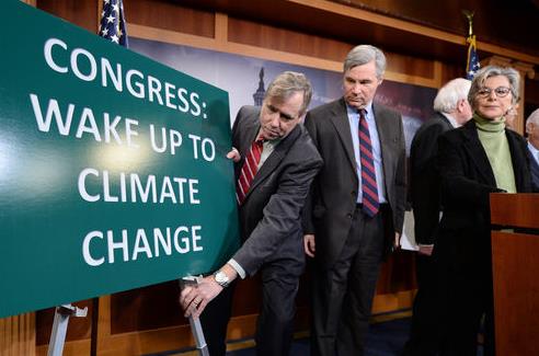
Why Climate Scientists Shouldn’t Testify Before Congress. Science 2.0 has an interesting story about the politicization of science, here’s a clip: “…Of course, the purpose of congressional hearings on science most often is not to actually expand or clarify the scope of choice available to decision makers, nor to convince neutrals or to win over the other side to one’s point of view. Rather, these hearings are meant to show and confirm solidarity with one’s own side. In this sense, they mark a breakdown of democratic deliberation…”
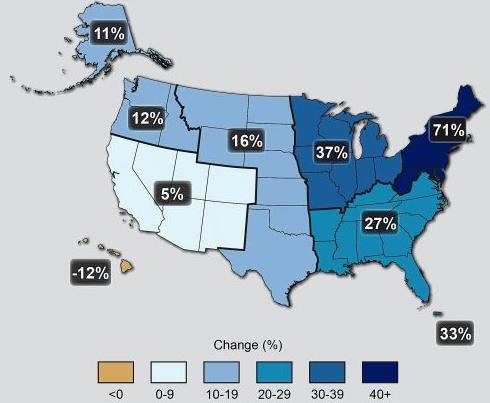
Why Bigger Snowstorms Come With Global Warming. Warmer air and ocean water is increasing water vapor, more fuel for flash floods in the summer months, and extreme snow events in the winter. In fact 5 of New York City’s biggest blizzards on record have all occurred in the last 12 years. Here’s an excerpt from a timely story at InsideClimate News: “…As the oceans warm due to the burning of fossil fuels, the atmosphere above can hold more moisture, which in turn fuels the creation of the most intense precipitation events. The mid-Atlantic is currently 2 degrees Fahrenheit above normal. In the spring, summer and fall, that translates into more of the most intense rainstorms. In the winter, when that moisture-rich air hits cold temperatures on the continent, heavier snowfall results. The amount of rain and snow falling in the heaviest precipitation events in the Northeast has jumped 71 percent in the last half-century, according to the 2014 National Climate Assessment….”
Is Climate Change To Blame For The Northeast Snow Storm? The short answer is no, the storm would have formed, with or without warmer air and sea surface temperatures. Did significantly warmer water in the Gulf Stream just east of New Jersey help to spike some of the winds and snowfall amounts? Probably. Here’s an excerpt from Huffington Post: “…Kevin Trenberth, a senior scientist in the climate analysis section at the National Center for Atmospheric Research, said that in winter, temperatures are generally colder on land than over the oceans. Climate change is raising ocean temperatures, however, and current sea surface temperatures are more the 2 degrees Fahrenheit higher than normal over much of the area off the East Coast of the United States, he explained to The Huffington Post. Trenberth also said that water vapor in the atmosphere is about 10 percent higher than normal, and about half of this change can be attributed to climate change…”
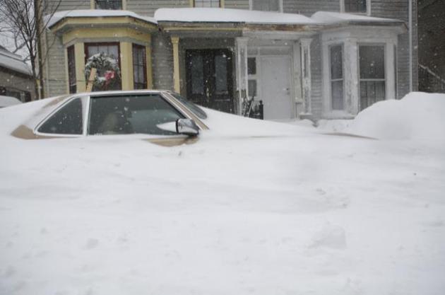
Photo credit: “A snow-entombed car in Cambridge, Mass., Jan 27, 2015. The first major storm of the winter blasted across eastern New England on Tuesday, unleashing whiteout conditions driven by gale-force winds.” (Katherine Taylor/The New York Times).
