38 F. high on Tuesday in the Twin Cities.
45 F. average high on March 24.
31 F. high on March 24, 2014.
30.8″ snow so far this winter season at KMSP.
62.7″ snow fell last winter, as of March 24, 2014.
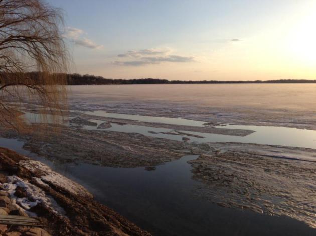
Uncharted Territory
As of Tuesday there hasn’t been a single March tornado reported anywhere in the USA. You have to go back to 1969 to find a comparable month. El Nino appears to be strengthening; this pervasive warm phase of the Pacific Ocean forecast to linger most of 2015. Every El Nino event is different, but most favor a southerly detour of the jet stream, a shift that diminishes the threat of tornadoes and hurricanes. That southward shift in steering winds may pinch off much of our moisture; I’m worried about an intensifying drought.
ECMWF guidance shows a potentially significant rain event brewing for the middle of next week, possibly ending as wet snow on April 1 or April 2. A potentially foul April Fool’s joke. Out ahead of this rare “storm” temperatures surge to near 60F Monday and Tuesday. That partially makes up for any late-season goosebumps tomorrow & Friday, when a fresh sweep of Canadian air keeps highs in the 30s.
And last night’s minor slush event? My favorite banker at Northern Trust, Jeff Huybrecht, wrote: “The great thing about a March snow is that it’s usually beautiful (wet snow that sticks to trees), melts quickly from roads and driveways, and provides needed moisture. What’s not to like?”
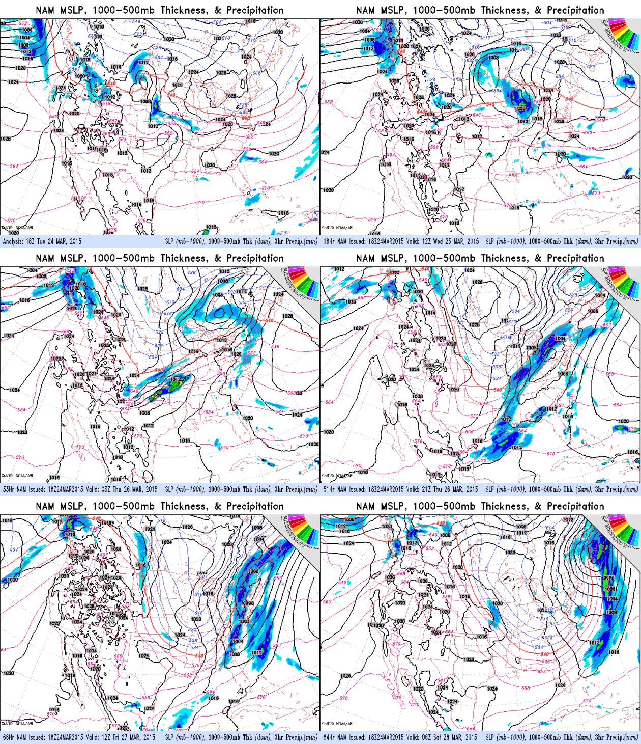
Colder Surge – Then Spring Returns Next Week. At least the sun will be out Thursday and Friday, when highs may not climb out of the 30s in the Twin Cities. A milder Pacific breeze kicks in over the weekend, the warmest temperatures early next week out ahead of a system that may pull steadier rain into Minnesota by midweek.
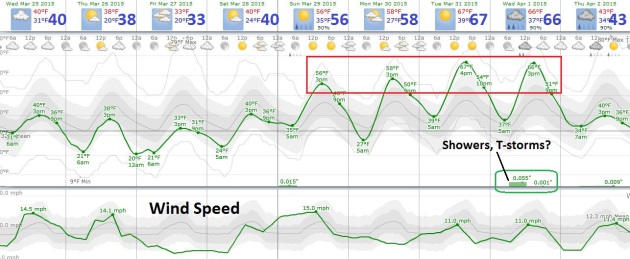
Another Spring Fling. After hovering about 5-10F colder than average into Saturday the mercury gets a nice boost next week with 50s and a few 60s the first half of the week. A period of rain midweek gives way to another cold front by the end of next week. Graphic: Weatherspark.
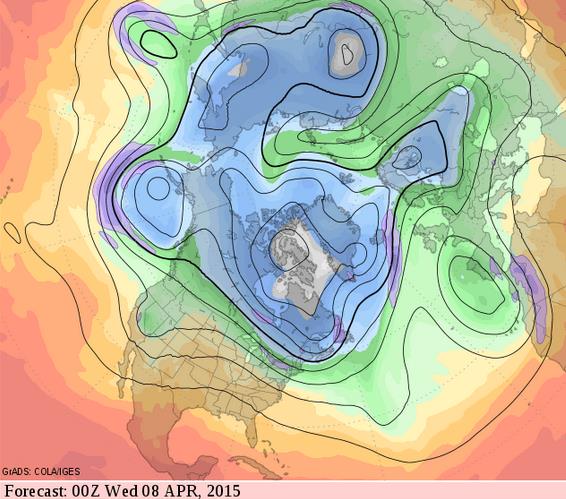
Moderating Temperatures Second Week of April. Within 2 weeks winds aloft (500 mb) are forecast to be strong and zonal, meaning highs mostly in the 50s. The pattern in early April still doesn’t look ripe for significant rain. Map: GrADS:COLA/IGES.
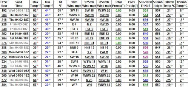
Flashes of Warmth. This is pretty typical for late March and early April; oscillating between 30s and slush to 60s and outbreaks of spring fever. Such will be the case in early April with highs mostly in the 50s, a few days of 40s and 60s, but nothing too outrageous in the temperature department. GFS data above: NOAA.
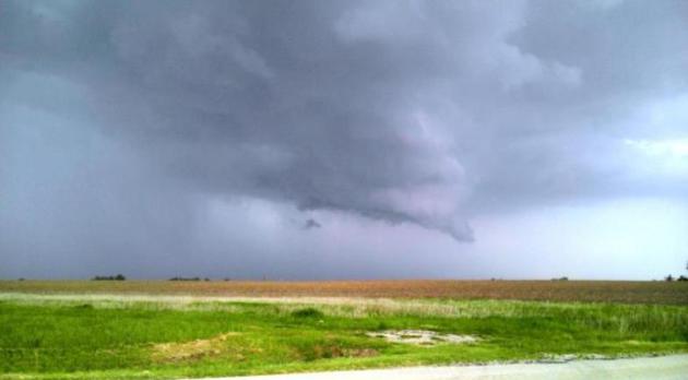
Odd Tornado Drought of 2015 Puts U.S. Into “Uncharted Territory”. Here’s a clip from a story at weather.com: “…There has still not been a single tornado reported anywhere in the U.S. so far in March 2015, through March 22. Only one other March – in 1969 – has gone tornadoless so deep in the month, according to reliable records dating to 1950. March 1969 had its first tornado of the month on March 23. The lowest U.S. March tornado count was six in 1951, though you could argue some weaker tornadoes may have been unobserved back then, in the pre-smartphone, pre-Doppler radar era. While March is not typically one of the most active months, March has averaged 78 tornadoes in the U.S. over the past 20 years, according to Forbes…”
Experimental Forecast Projects Tornado Season. A low-grade El Nino is already producing conditions downwind generally unfavorable for tornado formation – but there are exceptions to every rule. Here’s a clip from Climate Central: “…El Niño tends to tamp down on tornadoes because it shifts the jet stream further south over the U.S., which blocks moisture from flowing northward from the Gulf of Mexico. The moisture is one of the key ingredients for fostering the unstable, stormy atmospheric environment on which tornadoes thrive. La Niña acts in the opposite way, pushing the jet stream to the north and letting that moisture penetrate further into the heart of the country. Some of the biggest outbreaks in history — including the 1974 Super Outbreak, as well as the devastating 2011 season — occurred during La Niña years…”
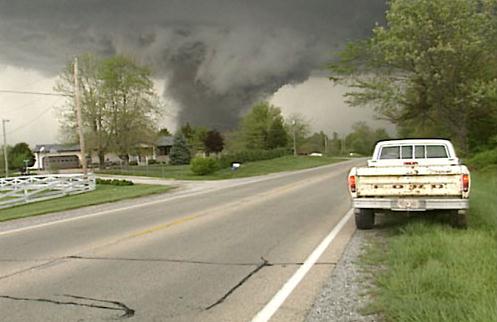
Storm Chasers Suddenly Out Of Work As Tornadoes Vanish in U.S. Bloomberg has more details on the weather pattern that is producing such a quiet March: “…The mechanics of the weather pattern causing heat in the West and cold in the East are easy to trace — a ridge of high pressure in the eastern Pacific and a trough of low pressure across central North America have locked in place. The pattern “is exactly the opposite of the pattern you need to get an active tornado period in late winter and early spring,” said Todd Crawford, a meteorologist at WSI in Andover, Massachusetts. Severe weather is usually more common when the West is cool and the East is warm, Crawford said. The chances of that happening anytime soon look slim...”
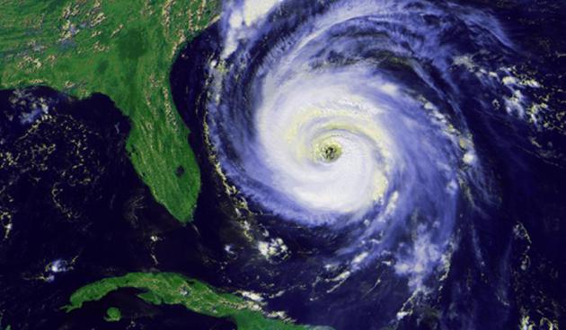
Image credit: “El Niño Makes Atlantic hurricanes less likely.” Credit: NOAA/ National Climatic Data Center.
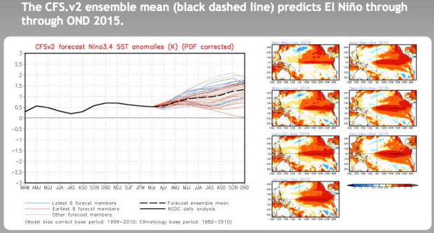
A More Significant (Longer Duration) El Nino Event in 2015? The Pacific continues to warm and factors may be converging to prolong some of this warmth into the end of 2015. Expect more warm weather records to be broken. Chart above: NOAA.
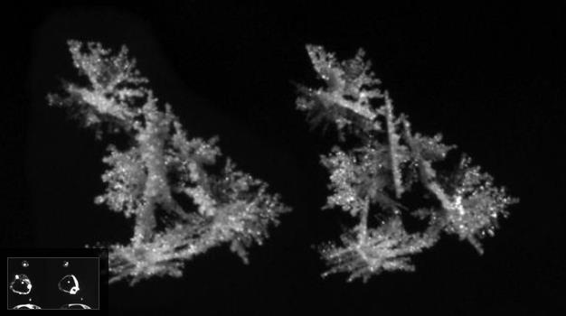
Snowflakes Aren’t Even Like Themselves, New 3D Images Reveal. Here’s an excerpt of an interesting article from LiveScience and Yahoo News: “You’ve heard that no two snowflakes are alike, but it gets even more complicated: The two sides of the same snowflake aren’t even alike. Now, researchers using a cutting-edge 3D camera are able to use these imperfections to update estimates of road slickness and other storm impacts, improving winter weather warnings in real time and saving lives…”
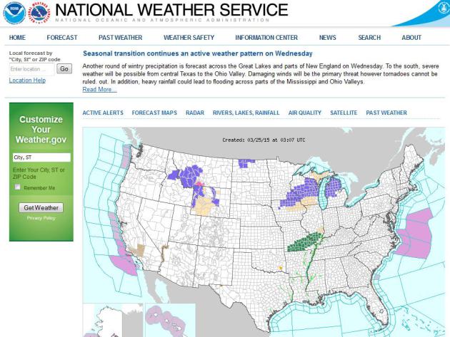
Troubled National Weather Web Sites Among Government’s Most Popular. Here’s a clip from an Andrew Freedman story at Mashable: “…Uccellini readily admitted that the NWS’ warning and forecast dissemination system “is broken.” “We are very aggressively trying to replace our dissemination system,” he told Mashable last year. “I’m not walking away or trying to hide.” The NWS has been prevented from developing its own mobile apps because of statutes that forbid it from competing with the private weather sector…”

U.N. Report Warns of Serious Water Shortages Within 15 Years. TIME has the story; here’s the introduction: “If we continue on our current trajectory, warns the report, we’ll only have 60% of the water we need in 2030 The world will only have 60% of the water it needs by 2030 without significant global policy change, according to a new report from the U.N. While countries like India are rapidly depleting their groundwater, rainfall patterns around the world are becoming more unpredictable due to global warming, meaning there will be less water in reserves...”

The War Over Who Steve Jobs Was. Backchannel at medium.com has an interesting look at the movement to clean up the iGenius’s image and ongoing legacy. Frankly I don’t even care if he was an a-hole. He pushed people to do things they didn’t even know they could accomplish and put a sizable dent in the (digital) universe. That’s quite enough for one life. Here’s an excerpt from the article: “…Isaacson’s eponymous biography of Jobs became a publishing phenomenon, selling over a million copies and making Isaacson himself somewhat of a celebrity. But privately, those closest to Jobs complained that Isaacson’s portrait focused too heavily on the Apple CEO’s worst behavior, and failed to present a 360-degree view of the person they knew. Though the book Steve Jobs gave copious evidence of its subject’s talent and achievements, millions of readers finished the book believing that he could be described with a word that rhymes with “gas hole...”

To Move Beyond Boom and Bust We Need A New Theory of Capitalism. Is there a better, smarter, more sustainable way to run the markets? Here’s an excerpt from The Guardian: “…Minsky’s genius was to show that financially complex capitalism is inherently unstable. Under conditions of stability, firms, banks and households will, over time, move from a position where their income pays off their debt, to one where it can only meet the interest payments on it. Finally, as instability rises, and central banks respond by expanding the supply of money, people end up borrowing just to pay back interest. The price of shares, homes and commodities rockets. Bust becomes inevitable…”

Driverless Cars Will Shield The Haves From The Have-Nots. Redefining the meaning of a “bubble”? Here’s a clip from a story at Fusion: “…That’s one of the things I found most interesting — and disturbing — about Mercedes’ vision of the future. It is the wealth bubble incarnate. It’s easy to forget there are housing projects, homeless people on the street, shelters, food desserts, etc. when you literally never have to see them. Not even in passing. Cars have always provided distance and protection from the wider world, but Benz’s F 015 takes it to a whole new level. Yes, it’s just a concept. But this is what a radically unequal world could look like in 15 years…”
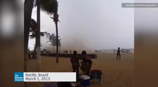
Waterspout Tears Through Beach in Brazil. Here’s a link to a few video clips, courtesy of Huffington Post. Call me crazy, but if a funnel is approaching you might not want to just stand on the beach: “A relaxing day at the beach turned dark after a waterspout made landfall over Candeias Beach in Brazil earlier this month. At first, according to Slate, beachgoers watched the waterspout from the beach as it churned over the ocean at a distance. The waterspout then moved quickly onto the beach, blowing debris and palm fronds in the air, according to a local report from Brazilian news site NE10…”

TODAY: Coating of slush early? Windy with more clouds than sun. Winds: W 15-30. High: 42
WEDNESDAY NIGHT: Patchy clouds, turning colder. Low: 21
THURSDAY: More clouds than sun, chilly for late March. High: 38
FRIDAY: Who turned off the heat? Brisk. Feels like late February, but the sun is out. Wake-up: 22. High: 35
SATURDAY: Breezy, turning milder with fading sun. Wake-up: 23. High: 44
SUNDAY: Mild, springy start. Late shower? Wake-up: 35. High: 54
MONDAY: Plenty of sun, pleasant. Wake-up: 33. High: 57
TUESDAY: Mild sun, first clap of thunder? Wake-up: 40. High: 62
* Heavier, steadier rain is possible next Wednesday as temperatures begin to fall.
Climate Stories…
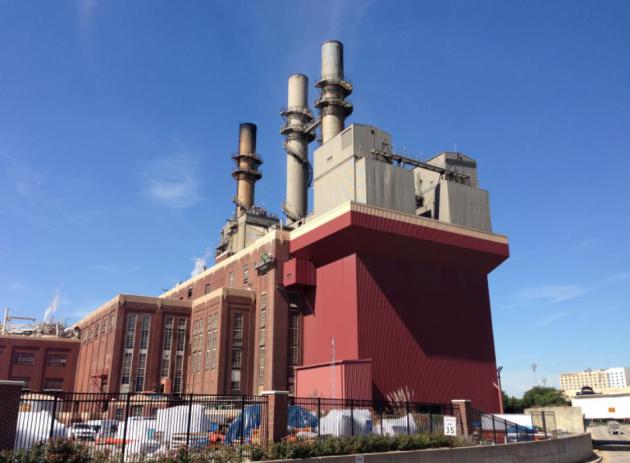
The Real Cost of Coal. The fundamental problem right now: the true cost of burning coal (and other fossil fuels) is not being factored into the markets. Fossil fuel companies are getting a free pass by being able to pump as much CO2 into the atmosphere as they want. Here’s a snippet of an Op-Ed at The New York Times: “…This failure by the government to collect fair value for taxpayer coal is made more troubling by the climate-change implications of burning this fossil fuel. Taxpayers are already incurring major costs in responding to the effects of global warming. Coastal infrastructure is being battered by sea rise and storm surges; forests are being devastated by climate-aided pest infestations; and studies are suggesting that temperature rises have increased the likelihood of devastating droughts in California...”
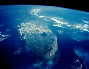
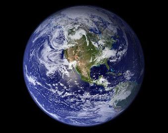
U.S. Is Laggard Among Developed Nations In Understanding Climate Change. InsideClimate News has an interesting article; here’s an excerpt: “…Capstick and his colleagues found that during the 1980s and 1990s, there was increasing awareness and public concern about the issue around the globe. In many countries, skepticism about the scientific evidence of climate change took hold late in the following decade, and climate quickly became a partisan issue largely because of the global recession and concern that taking action would hurt economies. But while most countries have since moved away from this partisan divide, the political split over climate change has only widened in the U.S., Capstick said. This reflects fossil fuel-funded denial campaigns and the widening ideological divide between conservative and progressives in the U.S. Australia and the U.K. have similar divides…”
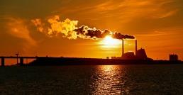
Carbon Price Should Increase Up To 200% To Avoid Tipping Point, Study Says. Blue and Green Tomorrow has the story – here’s an excerpt: “…In order to avoid dangerous levels of climate change and crossing irreversible tipping points in the future, the price of carbon should be increased by up to 200%, according to a new study. Researchers from the Universities of Exeter, Zurich, Stanford and Chicago have urged policymakers not to discount the damages from future climate tipping points. The study, which has been published the journal Nature Climate Change, argues that the prospect of future tipping points should greatly increase the amount we are willing to pay now to limit climate change…”
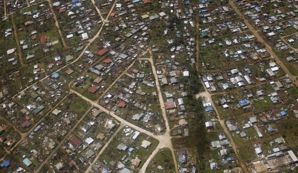
Cyclone Pam Is Just The Start. Newsweek puts the super-cyclone (same thing as a typhoon and hurricane) into perspective; here’s an excerpt: “In the wake of island nation Vanuatu’s devastation by Cyclone Pam, in which 320 mile-per-hour winds killed dozens of people and destroyed 90 percent of the buildings in the capital city of Port Vila, public health experts fear that the country’s ruined infrastructure will result in mass starvation and epidemics of disease. As the rate of global climate change continues to increase, such tragedies will become more and more common around the world. Vanuatu is not alone…”
Image credit above: “An aerial view of the destruction after Cyclone Pam hit Port Vila, capital city of the Pacific island nation of Vanuatu, on March 17, 2015.” Edgar Su/Reuters.
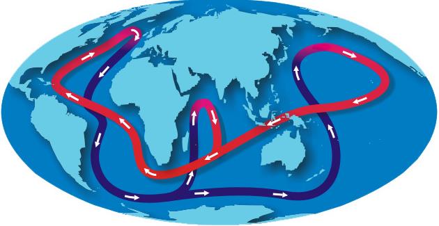
A Slow-Down In The North Atlantic Conveyer Belt? There was always concern among scientists that melting of (fresh) water, mainly from a rapidly melting Greenland, might impact the broad Atlantic Ocean circulation pattern. Chris Mooney has details of new research at The Washington Post; here’s an excerpt: “…According to a new study just out in Nature Climate Change by Stefan Rahmstorf of the Potsdam Institute for Climate Impact Research and a group of co-authors, we’re now seeing a slowdown of the great ocean circulation that, among other planetary roles, helps to partly drive the Gulf Stream off the U.S. east coast. The consequences could be dire – including significant extra sea level rise for coastal cities like New York and Boston...”
* The paper at Nature Climate Change is here.

