69 F. high in the Twin Cities Monday.
63 F. average high on April 27.
45 F. high on April 27, 2014.
April 27 in Minnesota Weather History. Source: Twin Cities National Weather Service.
2002: Heavy snow over the Twin Cities and central Minnesota. Chanhassen got half a foot. Vivid lightning seen with the snow during the evening.
1996: Low of 9 degrees at Embarrass. Ice was still on some central and most northern Minnesota lakes.
1921: Late season blizzard at Hibbing. The temperature was 75 degrees three days before.
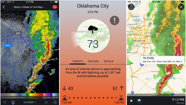
Situational Awareness
“Don’t push the weather” I remind my Navy son, ad nauseum. He flies helicopters, which don’t have weather radar on their multiple displays, I was surprised to learn.
But there’s no need to fly blind, not with the proliferation of web sites and apps out there today, many of them free. Why did Dauphin Island Regatta officials go forward with a sailboat race as a line of storms approached on Saturday? I have no idea and I won’t second-guess. But these deadly storms strengthened over Mobile Bay, Alabama, and this intense squall line showed up on hundreds of radar apps available for iOS and Android.
Doppler in your pocket is more than a convenience; it might even save your life. But many days we’re so anxious to get an event in or reach our destination on time that we ignore the warning signs.
Clouds increase today with an isolated shower; a better chance of thunder Friday with potentially soaking showers and T-storms Saturday night into Sunday as a sticky warm front approaches.
I do like the sound of that. Warm front.
According to NOAA there’s a 70 percent chance that El Nino will linger into the summer. Odds favor a warmer, drier summer than recent years.
Place your bets.
* Screen shots above: RadarScope (left image) and Aeris Pulse (middle and right), which was created by developers at my company, AerisWeather.
* More information on the aftermath of Alabama’s Regatta disaster here, courtesy of AL.com.
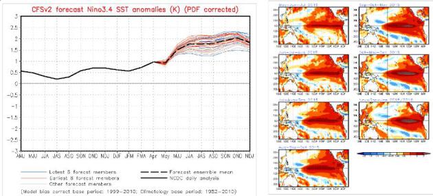
70% Chance of El Nino Lingering into Summer. NOAA CPC is also predicting a 60% chance of El Nino warming conditions spilling over into autumn. Some of the models (above) show temperature anomalies of 1.5 to 2.0C later in 2015.
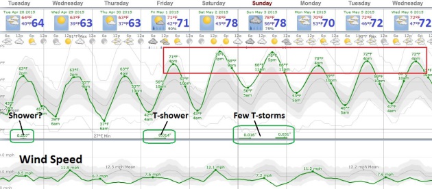
Looks Like May. Temperatures trend as much as 5-15F warmer than average into the first half of next week, 60s giving way to 70s. An isolated shower can’t be ruled out later today, a slight thunder chance Friday. The best chance of more widespread showers and T-storms comes late Saturday into Sunday as a sticky warm front approaches. Remember those?
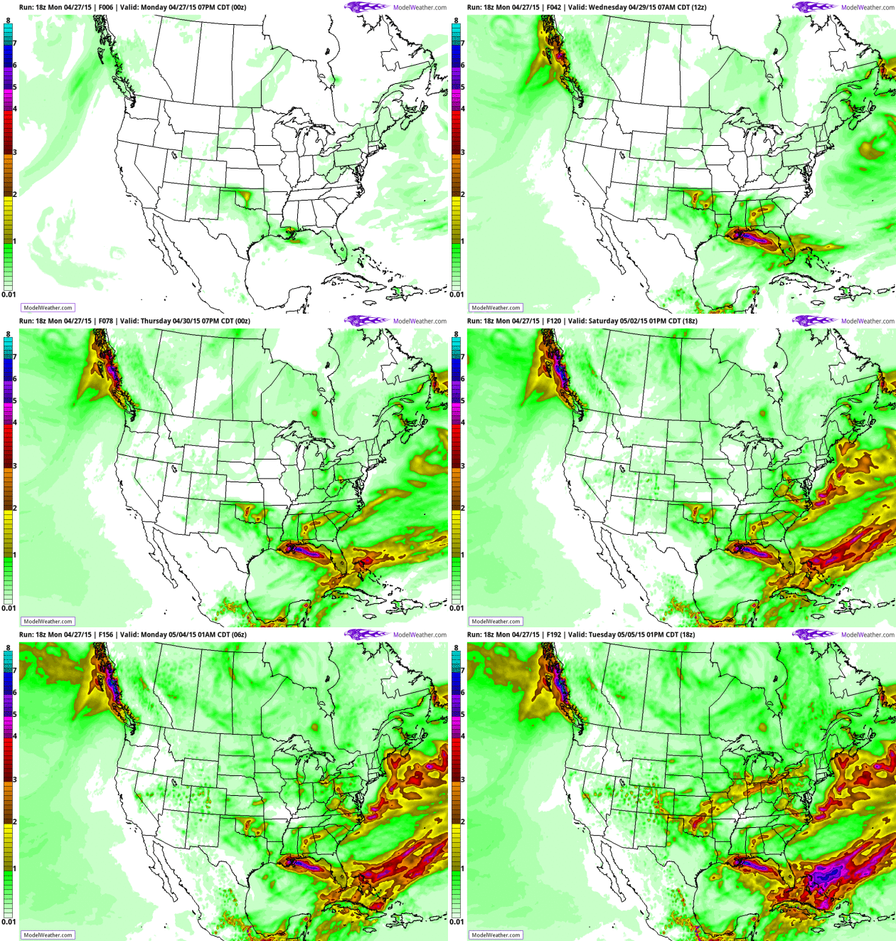
Accumulated Rainfall. NOAA.s .25 degree GFS data shows flooding rains from the Gulf Coast into Florida, another surge of heavy rain pushing into the Midwest and Great Lakes Sunday and Monday, but the heaviest rainfall amounts are forecast to stay south/east of Minnesota. Source: AerisWeather.
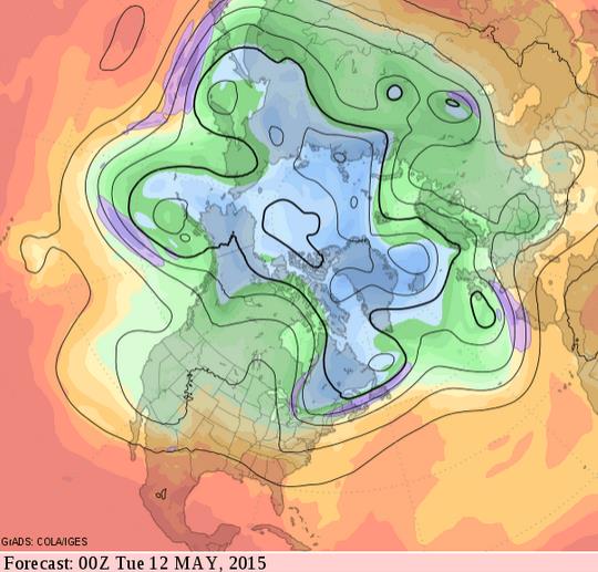
Warmer Than Average May? With a strong El Nino continuing to strengthen there’s evidence on the weather maps of a warm bias from May into much of the summer. Long range forecasting is always a hand-waving exercise, but there is a correlation between substantive El Nino warming phases in the Pacific and warm temperature anomalies downwind, over North America. 500 mb forecast winds for the evening of May 11 courtesy of GrADS:COLA/IGES.
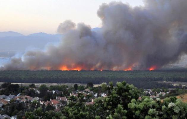
“Explosive” Wildfires Are Already Out of Control Months Before Fire Season. ThinkProgress has the latest; here’s the intro: “Wildfire season” seems to be a thing of the past for drought-stricken California, with fires now raging throughout the year. There have already been nearly 850 wildfires this year — 70 percent above the average, according to CAL FIRE data. High temperatures and low precipitation, both related to climate change, have dried out forests and scrublands across the western United States, allowing fires to spread faster and farther than usual, any time during the year...”
File photo credit above: “In this Saturday, April 18, 2015 photo provided by Daniel Cole, flames burn in the Prado Dam Flood Control Basin adjacent to homes, foreground, as seen from Corona, Calif. Cooperative weather and the efforts of firefighters helped beat back flames Sunday that had threatened hundreds of homes near the Southern California dam. Evacuation orders were lifted just before dawn for about 300 homes in an area along the border of the cities of Norco and Corona, about 35 miles southeast of downtown Los Angeles.” (Daniel Cole via AP).
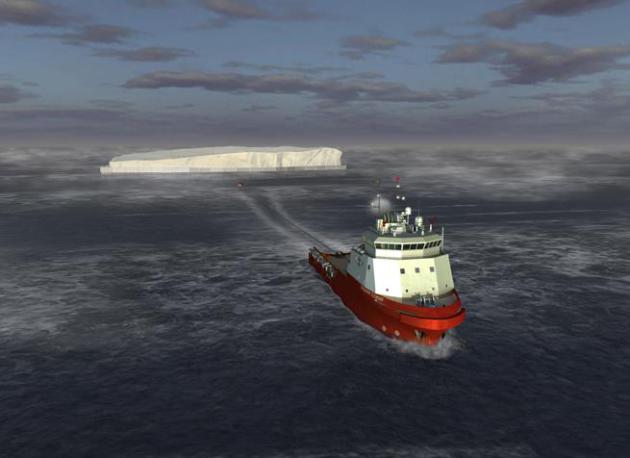
Import Our Water From Wetter Climes? It’s A Pipe Dream. As California enters the 4th year of a debilitating drought some of the proposed solutions are becoming more….creative. Here’s an excerpt of an Op-Ed at The Los Angeles Times: “If it only were this simple: Build a pipeline to Seattle and solve California’s water problems. Better yet: Lay pipe to the Great Lakes. Or sink pipe on the ocean floor and siphon water from Alaska. While we’re at it, tow an iceberg down from the Arctic. All these ideas and more have been suggested over the decades. Let’s get right to the point: They’re all nutty. Politically and financially unfeasible…” (photo courtesy of WIRED.com).
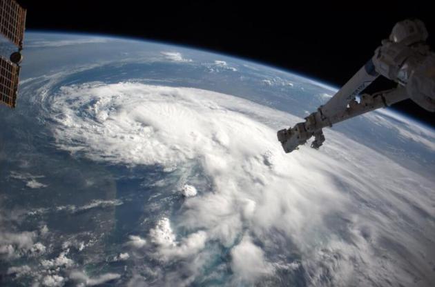
Hurricanes of Terror: Why Two Names Were Dropped From Storm List. No, there will be no Hurricane Isis this year; Live Science explains: “…Two hurricane names linked with terror and death were dropped from the Pacific storm list, the United Nations’ World Meteorological Organization announced Friday (April 17). The first, “Isis,” was booted from the 2016 list of hurricane names because of its association with the brutal Islamic State militant group, the WMO said. Isis, the name of an ancient Egyptian goddess, was replaced with “Ivette...” (Image of Hurricane Arthur: NASA).
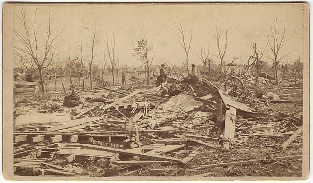
A Rare and Devastating F5. The photo above shows what was left of Rochester after the 1883 tornado roared across the city, leaving 37 dead and over 200 injured. Wikipedia has more details.
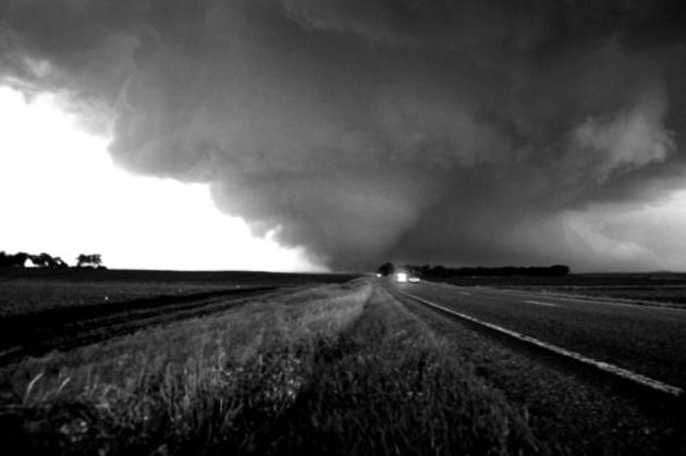
Seasonal Tornado Forecasts Could Soon Be A Reality, Researchers Say. Here’s an excerpt of an interesting story at The Oklahoman: “…But weather researchers at the National Oceanic and Atmospheric Administration’s National Severe Storms Laboratory and elsewhere are working on a new method they hope will allow emergency responders to prepare weeks ahead of time when tornadoes are likely. Harold Brooks, senior research scientist at the Norman-based laboratory, said scientists could be a few years away from being able to release seasonal forecasts for tornadoes. Rather than predicting individual outbreaks, those forecasts would predict how likely tornadoes were over the course of a few weeks or an entire season, he said…”
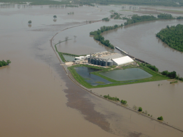

Why Your Next Home Might Be Battery-Powered. At least part of the time, and that’s the challenge: making sure there’s still a viable grid for the times when clean, renewable, solar or wind power isn’t available. Here’s an excerpt from The Washington Post: “…Only a few hundred U.S. homeowners — frustrated by their utility or seeking to go green — have worked with a small corps of battery makers to reduce their reliance on the national grid. But improving technology, falling prices and backing from electric-car giant Tesla could soon make the battery-powered home cheaper and easier than ever, challenging the long-held utility model of dependence on outside energy — and revolutionizing how America flicks on its lights…” (Photo credit: Fresh Energy).
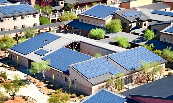
Like Shale Oil, Solar Power Is Shaking Up Global Energy. Here’s a snippet of an interesting article from Reuters: “…A crash in the prices of photovoltaic panels and improved technology that harnesses more power from the sun has placed solar on the cusp of a global boom, analysts say, who compare its rise to shale oil. “Just as shale extraction reconfigured oil and gas, no other technology is closer to transforming power markets than distributed and utility scale solar,” said consultancy Wood Mackenzie, which has a focus on the oil and gas industry. Oil major Exxon Mobil says that “solar capacity is expected to grow by more than 20 times from 2010 to 2040...” (Photo credit: Solar City).

Apple Won’t Always Rule. Just Look At IBM. I’m a fan of Apple, always will be, but how long can they sustain their run? Here’s an excerpt from The New York Times: “…Now it’s Apple’s world. Apple is the most widely held stock in American mutual fund portfolios. IBM, the former undisputed heavyweight champion, isn’t even in the running anymore. It ranks 62nd, according to a Morningstar analysis performed at my request. IBM is still an important company, but it is struggling. Investors judge it to be worth less than one-quarter of Apple’s market value today. What happened to IBM — how it became this small, in comparison with Apple — is worth remembering...”

The Full-Size Lego Car. Because some people have entirely too much free time. That said, it is pretty cool. Here’s a clip from kottke.org: “Raul Oaida built a full-sized car out of half-a-million Lego pieces that actually drives. The 256-cylinder engine is powered by compressed air. Top speed is 20 mph…”
TODAY: Clouds increase, stray shower possible. Winds: N 5-10. High: 66
TUESDAY NIGHT: Patchy clouds. Low: 45
WEDNESDAY: Sunnier and milder. High: 68
THURSDAY: Warm sunshine. Still amazing. Wake-up: 44. High: 67
FRIDAY: Unsettled, passing T-shower possible. Wake-up: 45. High: near 70
SATURDAY: Some sun, drier day of weekend. Wake-up: 51. High: 74
SUNDAY: Humid, scattered heavy T-showers. Wake-up: 56. High: 73
MONDAY: Gray, but drier and slightly cooler. Wake-up: 53. High: 68
Climate Stories…

Extreme Weather Already On The Increase Due To Climate Change, Study Says. Here’s an excerpt from The Guardian: “…Extreme heatwaves and heavy rain storms are already happening with increasing regularity worldwide because of manmade climate change, according to new research. Global warming over the last century means heat extremes that previously only occurred once every 1,000 days are happening four to five times more often, the study published in Nature Climate Change said. It found that one in five extreme rain events experienced globally are a result of the 0.85C global rise in temperatre since the Industrial Revolution, as power plants, factories and cars continue to pump out greenhouse gas emissions…”

New Study Links Weather Extremes to Global Warming. Here is additional perspective via Justin Gillis at The New York Times: “The moderate global warming that has already occurred as a result of human emissions is responsible for about 75 percent of daily heat extremes, and about 18 percent of precipitation extremes, scientists reported Monday. Especially hot days of a sort that occurred only once every 30 years or so before the Industrial Revolution are now occurring every six or seven years, the scientists found...”
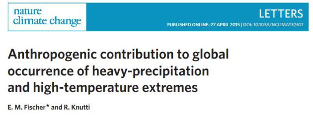
* The paper referenced above is here.
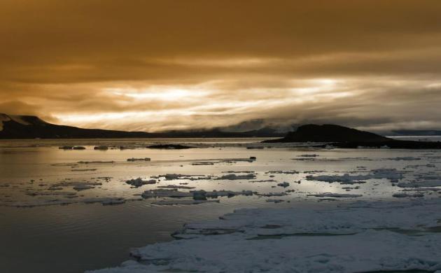
How The U.S. Plans To Combat Arctic Climate Change. Here’s the intro to a story from The Washington Post: “The United States and seven other Arctic nations vowed Friday to work together to combat climate change at the top of the world and put aside tensions over Ukraine and Russian military activities. As the United States assumed chairmanship of the Arctic Council, a multinational group formed to address environmental and economic issues, Secretary of State John F. Kerry said that the Arctic is undergoing profound climate change at an alarming pace that will affect northern coastal communities and, eventually, the world…”

U.S. Takes Reins of Arctic Council Amid Geopolitical Tension, Rapid Warming. Andrew Freedman has the article for Mashable; here’s an excerpt: “…The Arctic is one of the most rapidly warming places on the planet, with warming air and sea temperatures and melting ice rapidly transforming places from Fairbanks, Alaska to Svalbard, Norway from a forbidden, frozen landscape to a seasonally accessible area. Arctic sea ice has declined precipitously in recent years, with September sea ice extent falling 13% per decade since 1979. Projections show the Arctic Ocean is likely to become seasonally sea-ice free sometime between the next few years and 2050. Sea ice extent in March was the lowest on record for the month…” (File image: Jeremy Potter, NOAA).
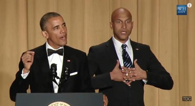
Obama Finally Gets Angry At Climate Science Deniers And It’s Hilarious. ThinkProgress has a review of President Obama’s performance at the White House Correspondent’s Gala; here’s an excerpt: “…But this was not only Obama’s best “speech” on climate change to date, it was delivered to the perfect audience — the DC elite and the panjandrums of the media. The “not-so-intelligentsia” have been wildly underplaying the story of the century for a long, long time. They should have called “Bull–” on deniers a long time ago. Kudos to the President for finally doing so.”
* A YouTube clip of Saturday night’s commentary is here, courtesy of The Daily Conversation.


I am reminded of an incident that happened near me last year. My daughter and I were watching a storm front come through the northern Twin Cities. We saw a very large not too far away ground strike, loud thunder quickly following. Then a few minutes later the sound of sirens, then a bit later an ambulance tearing south past us towards the nearest emergency room.
It turned out to be a woman at a sporting event in Blaine, some sort of little league tournament, injured by a lightning ground strike. I recall that she was injured fairly badly. The tournament, frankly, should have been called off for that day (may be for two days running, given the weather predictions) and certainly not continued if not called off while the storm front, visible on that pocket doppler everyone has, came through.
Hi Greg – yes, this is a real concern, especially when you have thousands of people gathered for an outdoor event. There is so much pressure to get the event off on time, and the almighty dollar sometimes overshadows common sense and prudent action (imagine that!) It’s a tough calculus, but people have to realize that you can only push the weather so far – or not be surprised when people are injured…or worse.