by Paul Douglas | Oct 8, 2017 | Blog
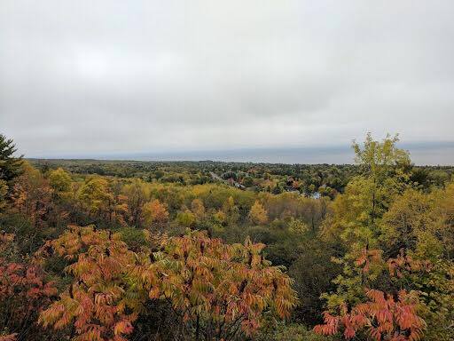
Fall Color Continues Thanks to Lee Huffman for this nice picture who is spending some time along MN’s North Shore this weekend. Despite lingering clouds early Saturday, the weekend turned out to be a pretty decent. Minnesota Fall Color Update According the MN...

by Paul Douglas | Oct 7, 2017 | Blog
“There’s going to be a beautiful meteor shower this weekend – here’s when you need to look up” “The Draconid meteor shower has been known to send 1,000 meteors an hour flying through the sky. Luckily for us countryside-dwellers, our...
.gif)
by Paul Douglas | Oct 6, 2017 | Blog
Tracking NATE in the Atlantic Here’s a look at NATE from midday Thursday, which according to NOAA’s NHC, was a Tropical Storm with sustained winds of 40mph. Note that this is the fourteenth named storm the 2017 Atlantic Hurricane Season. Tracking NATE in...

by Paul Douglas | Oct 5, 2017 | Blog
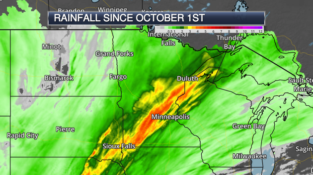
Heavy Rain To Begin October (map: AerisWeather) If there was one word to describe the first few days of this month, “wet” would certainly be that word. Particularly between Monday and Tuesday a stripe of 3″+ of rain fell from Sioux Falls to the north...
by Paul Douglas | Oct 4, 2017 | Blog
72 F. high temperature in the Twin Cities Tuesday. 64 F. average high on October 3. 76 F. high on October 3, 2016. October 4, 2005: Widespread heavy rain falls in Minnesota. 4.61 inches of rain falls in the Minneapolis area, 3.42 inches is recorded in St. Cloud, 2.28...
by Paul Douglas | Oct 3, 2017 | Blog
71 F. maximum temperature yesterday in the Twin Cities. 65 F. average high on October 2. 76 F. high in the Twin Cities on October 2, 2016. October 3, 1999: The earliest ever single digit temperature in Minnesota is recorded at Embarrass, with a low of 9. October 3,...


.gif)
