Paul Douglas
  • Biography
  • Speeches
    • Testimonials
  • Entrepreneurial Approach
    • Paul’s Companies
  • Legal Storm
  • News
    • Scientific Sources
  • Contact
Select Page
Soggy Start – Sticky Finish. June 2014: Wettest Month in Minnesota History

Soggy Start – Sticky Finish. June 2014: Wettest Month in Minnesota History

by Paul Douglas | Jul 5, 2014 | Blog

78 F. high in the Twin Cities Friday. 83 F. average high on July 4. 90 F. high on July 4, 2013. Slight severe storm risk Red River Valley later today. First 90 F. high of 2014 possible tomorrow. Wash. Rinse. Repeat. I wish Mother Nature would kick back with a cold one...

Fine 4th of July. June, 2014: Wettest Month, Statewide, in Recorded Minnesota History

Fine 4th of July. June, 2014: Wettest Month, Statewide, in Recorded Minnesota History

by Paul Douglas | Jul 4, 2014 | Blog

78 F. high in the Twin Cities Thursday. 83 F. average high on July 3. 84 F. high on July 3, 2013. July 3 Minnesota Weather History. Source: MPX National Weather Service: 1999: Windstorm knocked down millions of trees in the BWCA, 19 people were injured. 1977: An...
More October 1 than July 1 – Potential for Tropical Storm Arthur impacting Carolinas Increases

More October 1 than July 1 – Potential for Tropical Storm Arthur impacting Carolinas Increases

by Paul Douglas | Jul 1, 2014 | Blog

81 F. high in the Twin Cities Monday. 83 F. average high on June 30. 82 F. high on June 30, 2013. 11.36″ rain fell in June; wettest since 1874 (when 11.67″ fell). 60s today, nearly 20F. cooler than average. First World Problems “Paul, will there be a...
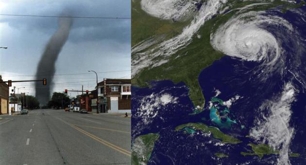
Wettest June for Twin Cities since 1874 – Growing Tropical Risk East Coast Later This Week

Wettest June for Twin Cities since 1874 – Growing Tropical Risk East Coast Later This Week

by Paul Douglas | Jun 30, 2014 | Blog

85 F. high in the Twin Cities Sunday. 83 F. average high on June 29. 77 F. high on June 29, 2013. .01″ rain fell at MSP International yesterday. 11.36″ rain so far this month in the Twin Cities. 4.11″ normal June rainfall as of June 29. June 29 in...
Severe Storm Risk Southern Minnesota – .40″ Away From All-Time June Rainfall Record

Severe Storm Risk Southern Minnesota – .40″ Away From All-Time June Rainfall Record

by Paul Douglas | Jun 29, 2014 | Blog

83 F. high in the Twin Cities Saturday. 82 F. average high on June 28. 79 F. high on June 28, 2013. .42″ fell yesterday at MSP International. 11.27″ rainfall so far in June. 11.67″ all-time June rainfall record for MSP (1874). Living a Vacation...
« Older Entries
Next Entries »

Caring For Creation Book

Recent Posts

  • Tracking Superior Refinery Fire Plume – Spotty Shower Today – Fine Weekend Brewing April 27, 2018
  • Spotty Instability Showers Next 36 Hours – Weekend Warming Trend April 26, 2018
  • An Extended Spring Fling – Wetter/Stormier Pattern Next Week? April 25, 2018

Archives

  • April 2018
  • March 2018
  • February 2018
  • January 2018
  • December 2017
  • November 2017
  • October 2017
  • September 2017
  • August 2017
  • July 2017
  • June 2017
  • May 2017
  • April 2017
  • March 2017
  • February 2017
  • January 2017
  • December 2016
  • November 2016
  • October 2016
  • September 2016
  • August 2016
  • July 2016
  • June 2016
  • May 2016
  • April 2016
  • March 2016
  • February 2016
  • January 2016
  • December 2015
  • November 2015
  • October 2015
  • September 2015
  • August 2015
  • July 2015
  • June 2015
  • May 2015
  • April 2015
  • March 2015
  • February 2015
  • January 2015
  • December 2014
  • November 2014
  • October 2014
  • September 2014
  • August 2014
  • July 2014
  • June 2014
  • May 2014
  • April 2014
  • March 2014

Latest Post

  • Tracking Superior Refinery Fire Plume – Spotty Shower Today – Fine Weekend Brewing
  • Facebook
  • Twitter
  • RSS
Website designed by Walt Kruhoeffer