by Paul Douglas | Dec 6, 2017 | Blog
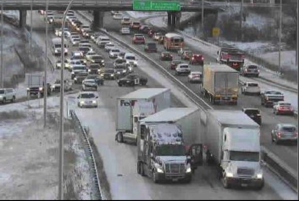
Icy Slushy Snowy Mess on Area Roads AM Tuesday Here was the view from a MN DOT webcam early Tuesday morning after 1″ to nearly 3″ of snow fell across parts of the metro Monday night. Unfortunately, precipitation started off as rain and changed to wet snow...
by Paul Douglas | Dec 5, 2017 | Blog
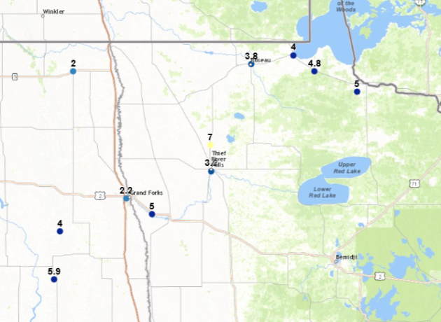
Snowfall Totals Through 6 PM Monday Through the early evening hours Monday, snow totals had only been reported across parts of northwestern Minnesota. The highest total was 7″ in Holt, which is north of Thief River Falls. You can view this interactive map from...
by Paul Douglas | Dec 3, 2017 | Blog
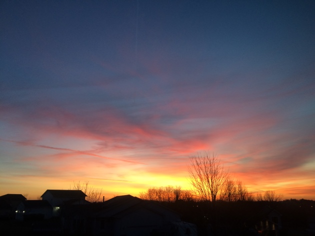
Sunday Sunrise Hope you enjoyed the sunrise on Sunday as it marked the last sunrise with mild temperatures before a big drop in temperatures takes us through the first full week of December. In fact, high temps will drop into the 10s and 20s, which will be 5F to...
by Paul Douglas | Dec 2, 2017 | Blog
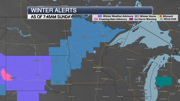
Sunday Morning Winter Storm Watch Update Winter Storm Watches have been extended to include more of northern and western Minnesota than what they covered last night. The heaviest snow is still expected to fall over parts of north-central Minnesota and the Arrowhead,...

by Paul Douglas | Dec 2, 2017 | Blog
Mild Weekend, Followed By Reality Check Next Week There’s a good chance we’ll see 50 degrees in the metro area Sunday and early Monday. No small feat, considering the Winter Solstice is less than 3 weeks away. The sun is lowest in the southern sky on...
