by Paul Douglas | Jul 9, 2017 | Blog
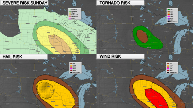
Severe Threat Sunday Night As we head through the rest of Sunday evening and into the overnight hours, there is an Enhanced Risk of severe weather from the Twin Cities to the southeast, indicating a higher chance of seeing severe weather. The main threat across this...
by Paul Douglas | Jul 9, 2017 | Blog
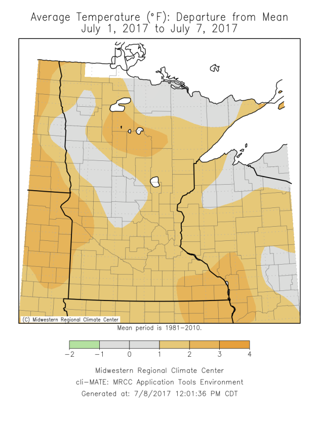
Warm Start To July So Far The past few days have been around or warmer than average across the state, helping to bring the mean temperature through the first week of July to above average levels in many areas. This follows recent trends, according to University of...

by Paul Douglas | Jul 5, 2017 | Blog
86 F. maximum temperature yesterday in the MSP metro. 83 F. Twin Cities average high on July 4. 80 F. high on July 4, 2016. July 5, 1999: Flooding occurs over the Arrowhead. The largest 24-hour rainfall total is 8.84 inches in central St. Louis County. July Warmth,...

by Paul Douglas | Jul 4, 2017 | Blog
81 F. Maximum temperature yesterday in the MSP metro area. 83 F. Twin Cities average high on July 3. 80 F. high temperature on July 3, 2016. July 4, 1999: Severe winds knock down millions of trees in the BWCA, injuring 19 people. July 4, 1962: An extremely heavy...

by Paul Douglas | Jul 3, 2017 | Blog
80 F. maximum temperature in the Twin Cities Sunday. 83 F. average high on July 3. 79 F. high on July 3, 2016. July 3, 1947: Tornadoes hit Marshall and Polk Counties. Potentially Thundery 4th – Hotter Late Next Week “It’s too cool for the lake...
